MyTopo
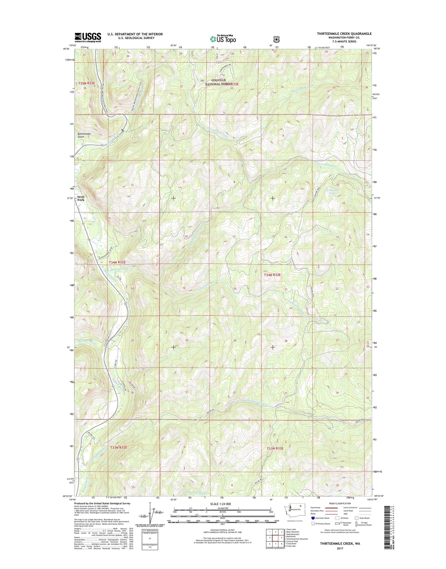
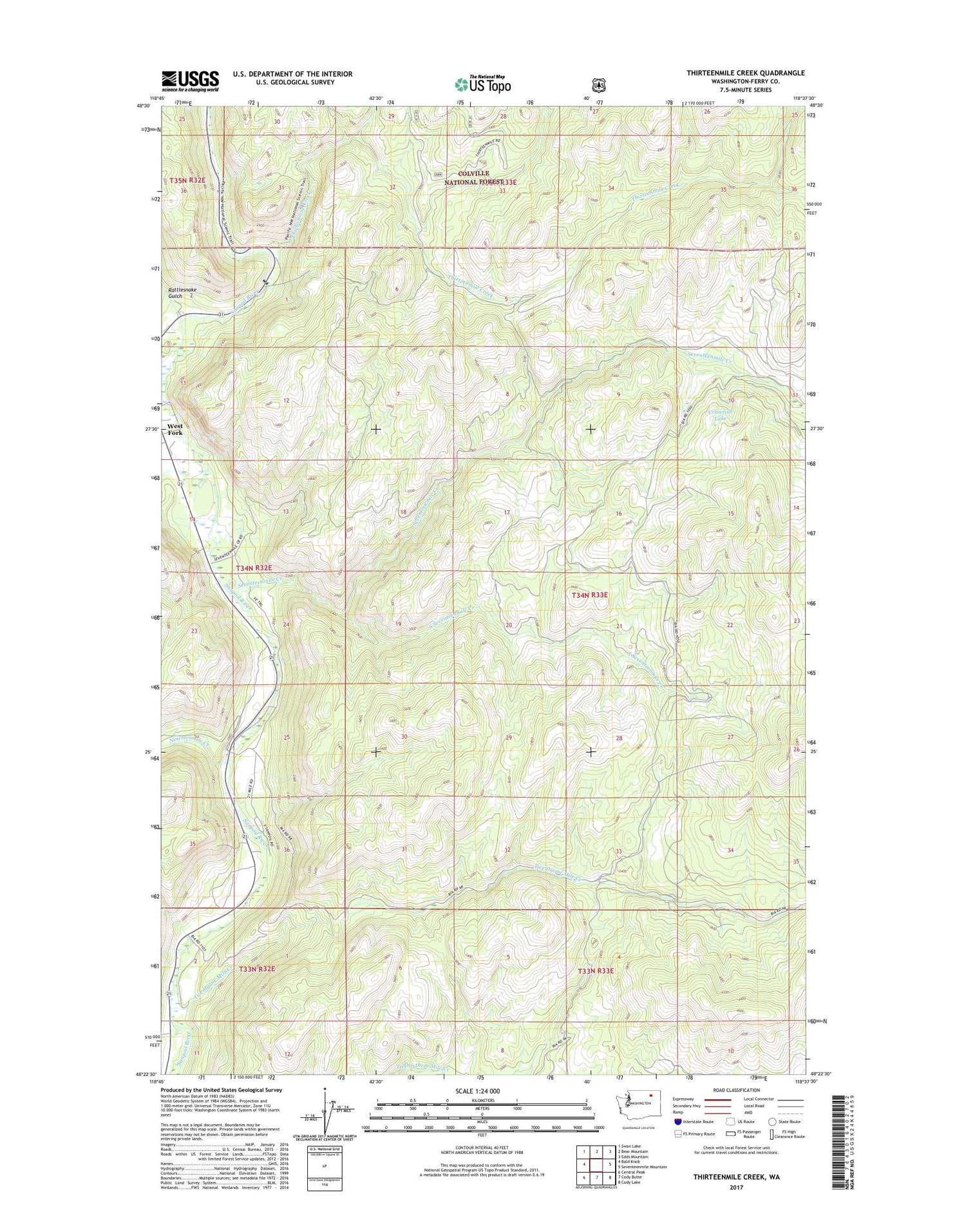
Thirteenmile Creek Washington US Topo Map
Couldn't load pickup availability
Also explore the Thirteenmile Creek Forest Service Topo of this same quad for updated USFS data
2023 topographic map quadrangle Thirteenmile Creek in the state of Washington. Scale: 1:24000. Based on the newly updated USGS 7.5' US Topo map series, this map is in the following counties: Ferry. The map contains contour data, water features, and other items you are used to seeing on USGS maps, but also has updated roads and other features. This is the next generation of topographic maps. Printed on high-quality waterproof paper with UV fade-resistant inks.
Quads adjacent to this one:
West: Bald Knob
Northwest: Swan Lake
North: Bear Mountain
Northeast: Edds Mountain
East: Seventeenmile Mountain
Southeast: Cody Lake
South: Cody Butte
Southwest: Central Peak
This map covers the same area as the classic USGS quad with code o48118d6.
Contains the following named places: Anderson Creek, Nineteenmile Creek, Rattlesnake Gulch, Seventeenmile Creek, Seventeenmile Trail, South Seventeenmile Creek, Thirteenmile Campground, Thirteenmile Creek, Thirteenmile Hiking Trail, Thirteenmile Road, Twentyone Mile Campground, Twentyone Mile Creek, West Fork Sanpoil River