MyTopo
Benton City Washington US Topo Map
Couldn't load pickup availability
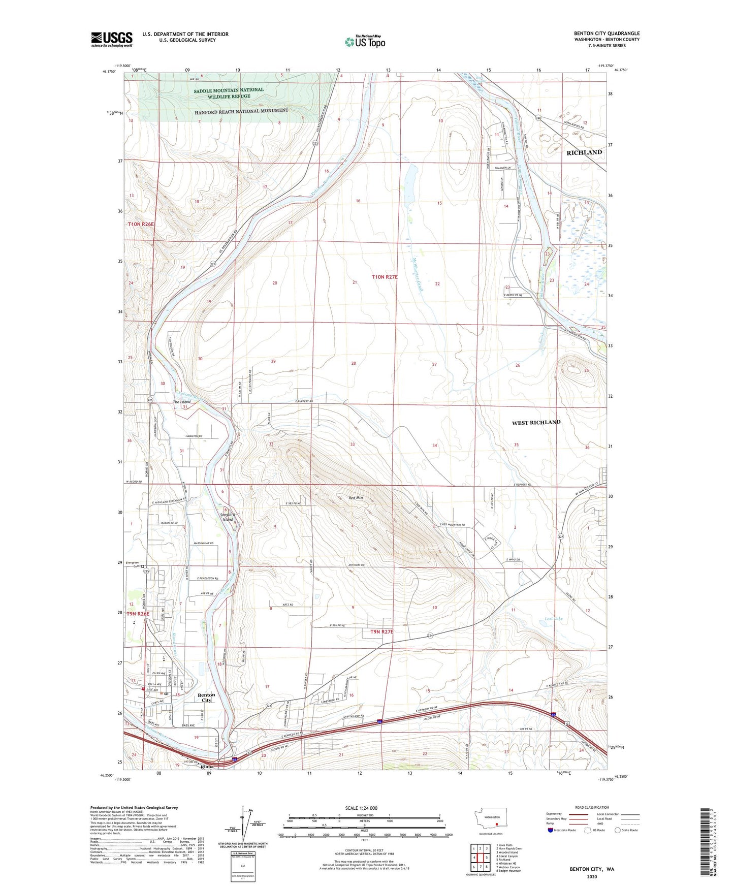
2020 topographic map quadrangle Benton City in the state of Washington. Scale: 1:24000. Based on the newly updated USGS 7.5' US Topo map series, this map is in the following counties: Benton. The map contains contour data, water features, and other items you are used to seeing on USGS maps, but also has updated roads and other features. This is the next generation of topographic maps. Printed on high-quality waterproof paper with UV fade-resistant inks.
Quads adjacent to this one:
West: Corral Canyon
Northwest: Iowa Flats
North: Horn Rapids Dam
Northeast: Wooded Island
East: Richland
Southeast: Badger Mountain
South: Webber Canyon
Southwest: Whitstran NE
Contains the following named places: Benton City, Benton City Post Office, Benton County Fire District 2, City of Benton City, City of West Richland, Evergreen Cemetery, Grosscup, Horn Rapids Canal, Kiona - Benton City Elementary School, Lost Lake, McWhorter Canal, Red Mountain, Songbird Island, The Island, ZIP Codes: 99320, 99353