MyTopo
Corral Canyon Washington US Topo Map
Couldn't load pickup availability
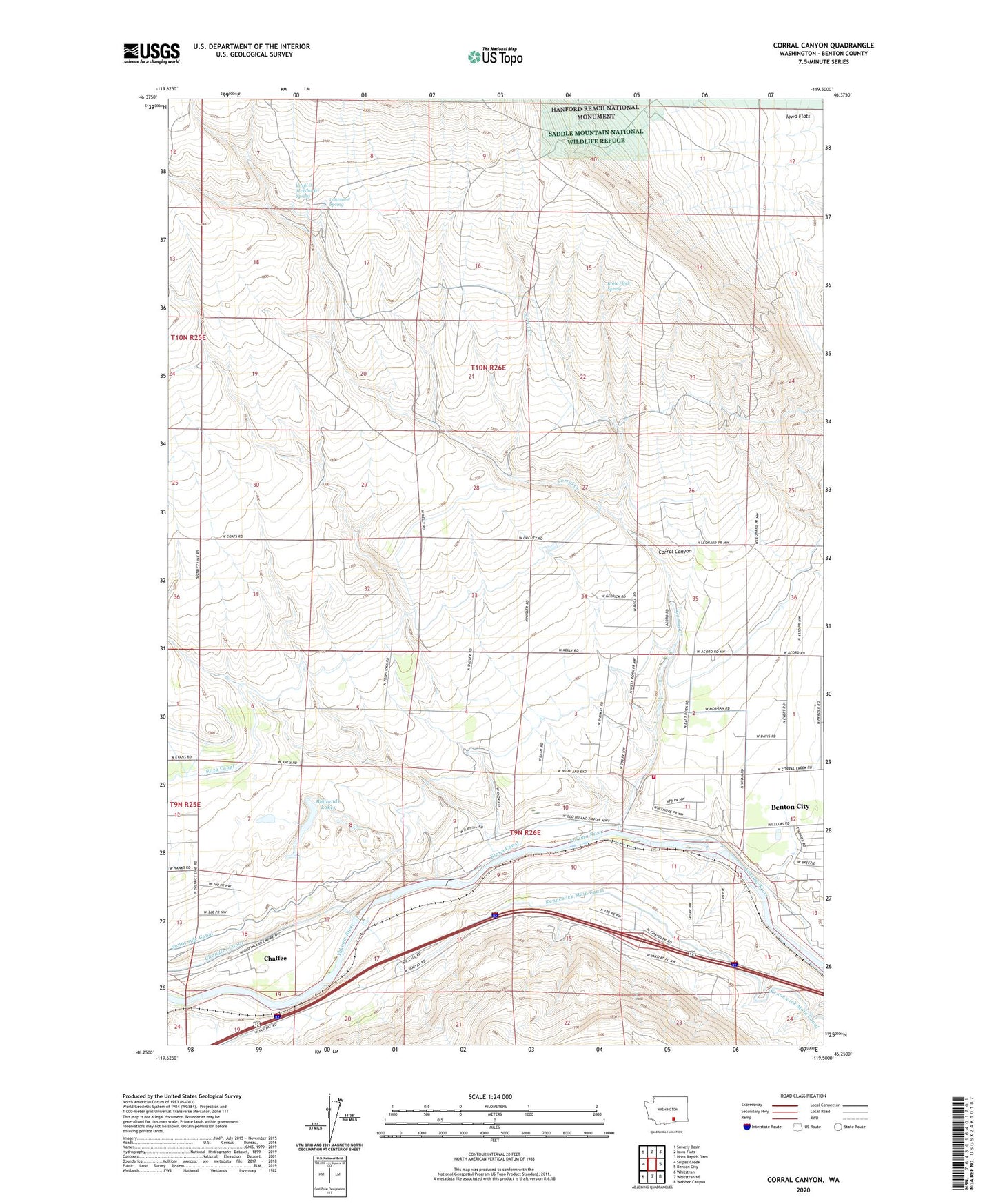
2023 topographic map quadrangle Corral Canyon in the state of Washington. Scale: 1:24000. Based on the newly updated USGS 7.5' US Topo map series, this map is in the following counties: Benton. The map contains contour data, water features, and other items you are used to seeing on USGS maps, but also has updated roads and other features. This is the next generation of topographic maps. Printed on high-quality waterproof paper with UV fade-resistant inks.
Quads adjacent to this one:
West: Snipes Creek
Northwest: Snively Basin
North: Iowa Flats
Northeast: Horn Rapids Dam
East: Benton City
Southeast: Webber Canyon
South: Whitstran NE
Southwest: Whitstran
This map covers the same area as the classic USGS quad with code o46119c5.
Contains the following named places: Badlands Lakes, Benton City Division, Benton County Fire District 2 Station 220, Chaffee, Chandler, Chandler Power and Pumping Plant, Corral Canyon, Corral Creek, Hodges Ranch, Katie Fleck Spring, Kiona Canal, Lonesome Spring, Mc Whorter Ranch Airport, McWhorter Ranch, Orcutt Well, Rattlesnake Slope State Wildlife Recreation Area, The Badlands, Virgil O McWhorter Spring