MyTopo
Wooded Island Washington US Topo Map
Couldn't load pickup availability
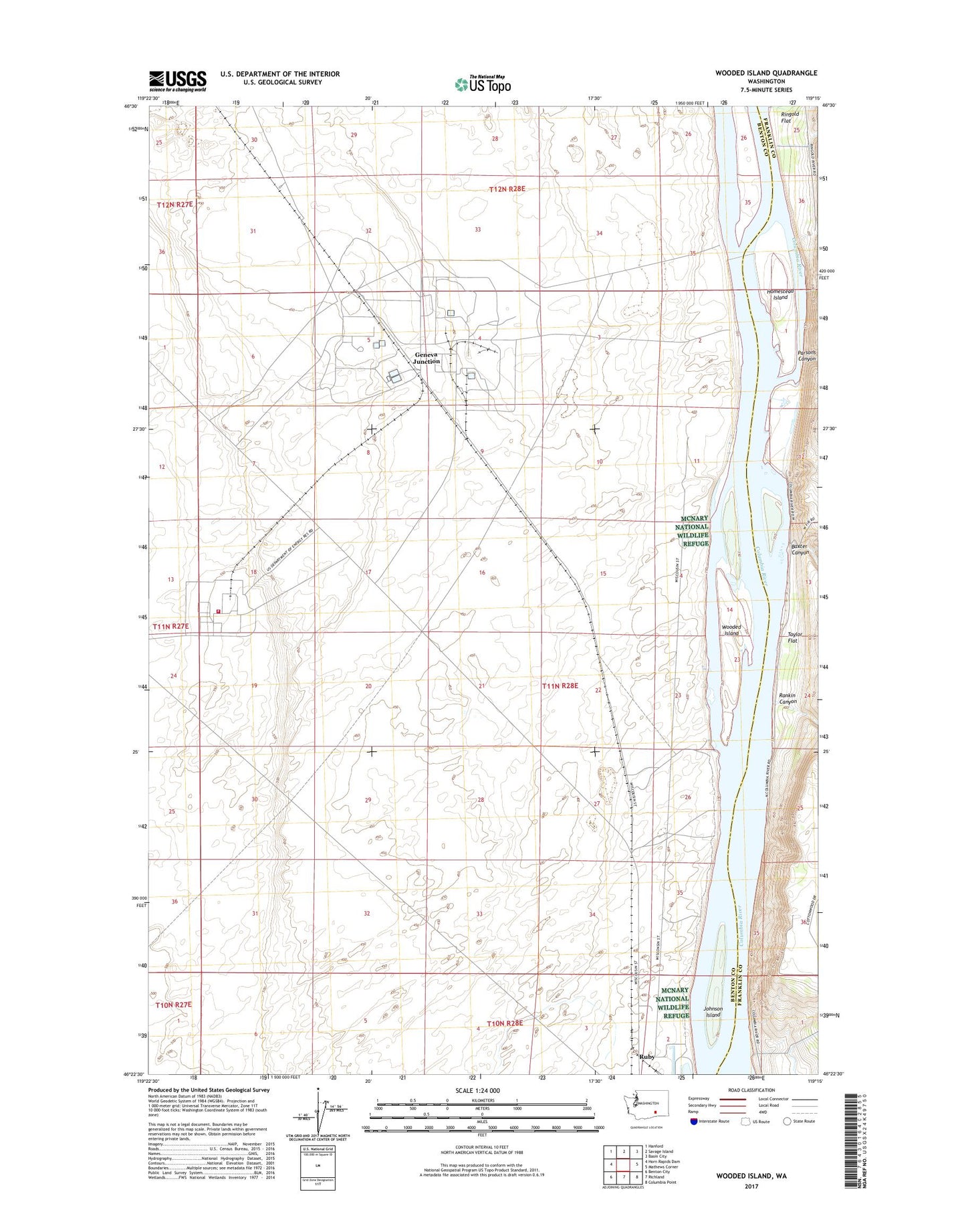
2023 topographic map quadrangle Wooded Island in the state of Washington. Scale: 1:24000. Based on the newly updated USGS 7.5' US Topo map series, this map is in the following counties: Benton, Franklin. The map contains contour data, water features, and other items you are used to seeing on USGS maps, but also has updated roads and other features. This is the next generation of topographic maps. Printed on high-quality waterproof paper with UV fade-resistant inks.
Quads adjacent to this one:
West: Horn Rapids Dam
Northwest: Hanford
North: Savage Island
Northeast: Basin City
East: Mathews Corner
Southeast: Columbia Point
South: Richland
Southwest: Benton City
This map covers the same area as the classic USGS quad with code o46119d3.
Contains the following named places: Baxter Canyon, Department of Energy Hanford Site - Hanford Fire Department Station 94, Fast Flux Test Facility, Geneva Junction, Homestead Island, Johnson Island, Parsons Canyon, Rankin Canyon, Ruby, Taylor Flat, Three Hundred North Radioactive Waste Dump, WNP-2 Plant Support Facility Heliport, Wooded Island, Wye Radioactive Waste Dump