MyTopo
Boot Mountain Washington US Topo Map
Couldn't load pickup availability
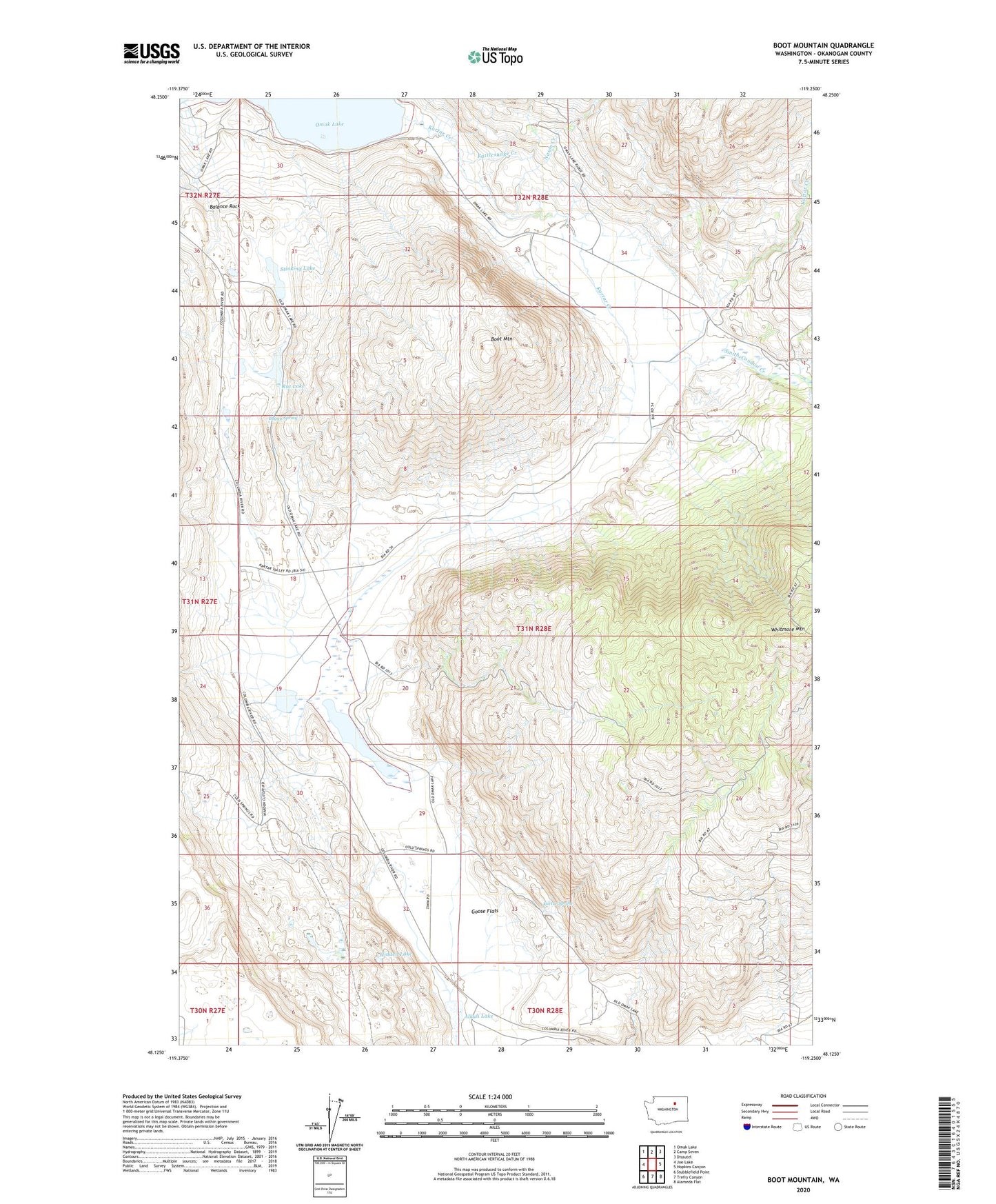
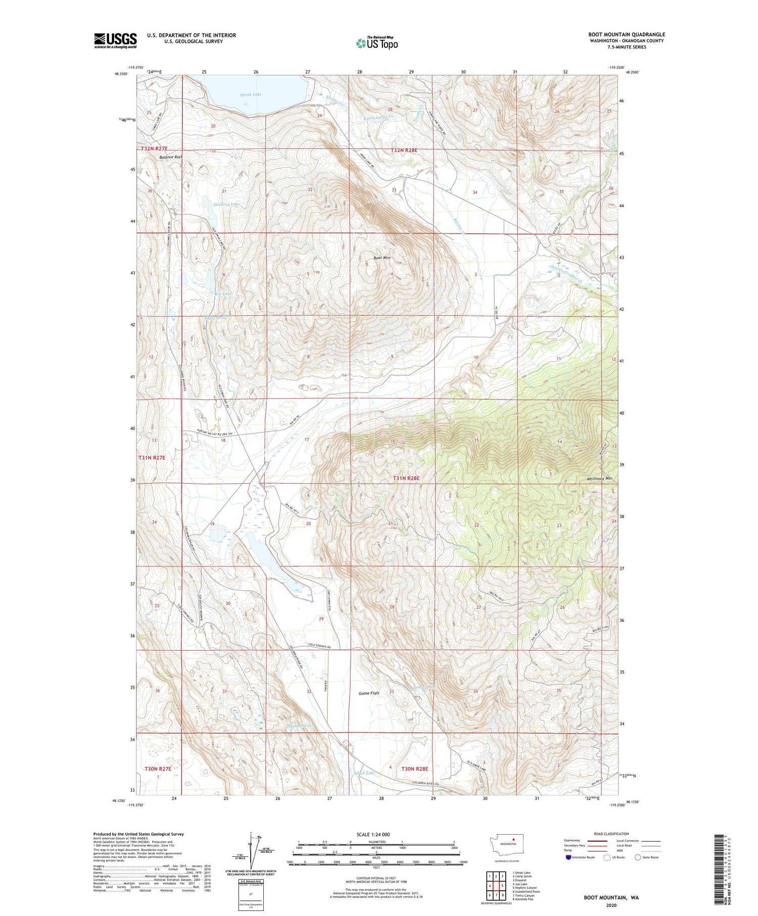
2020 topographic map quadrangle Boot Mountain in the state of Washington. Scale: 1:24000. Based on the newly updated USGS 7.5' US Topo map series, this map is in the following counties: Okanogan. The map contains contour data, water features, and other items you are used to seeing on USGS maps, but also has updated roads and other features. This is the next generation of topographic maps. Printed on high-quality waterproof paper with UV fade-resistant inks.
Quads adjacent to this one:
West: Joe Lake
Northwest: Omak Lake
North: Camp Seven
Northeast: Disautel
East: Hopkins Canyon
Southeast: Alameda Flat
South: Trefry Canyon
Southwest: Stubblefield Point
Contains the following named places: Alkali Lake, Balance Rock, Boot Mountain, Buggy Spring, Goose Flats, Goose Lake, Hidden Lake, Kartar Creek, Kartar Spring, Nason Creek, Rat Lake, Rattlesnake Creek, Smith-Condon Creek, Stinking Lake