MyTopo
Trefry Canyon Washington US Topo Map
Couldn't load pickup availability
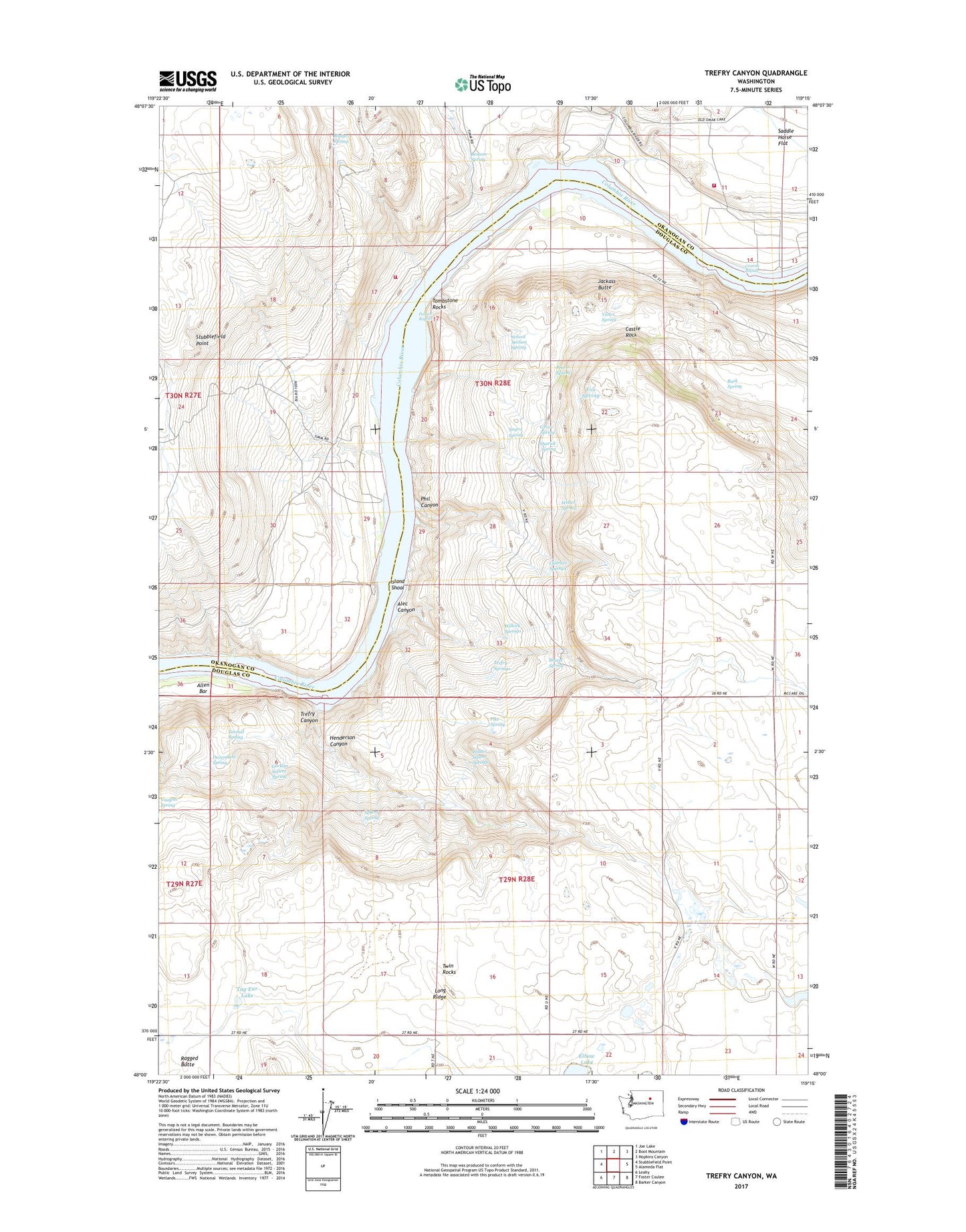
2023 topographic map quadrangle Trefry Canyon in the state of Washington. Scale: 1:24000. Based on the newly updated USGS 7.5' US Topo map series, this map is in the following counties: Douglas, Okanogan. The map contains contour data, water features, and other items you are used to seeing on USGS maps, but also has updated roads and other features. This is the next generation of topographic maps. Printed on high-quality waterproof paper with UV fade-resistant inks.
Quads adjacent to this one:
West: Stubblefield Point
Northwest: Joe Lake
North: Boot Mountain
Northeast: Hopkins Canyon
East: Alameda Flat
Southeast: Barker Canyon
South: Foster Coulee
Southwest: Leahy
This map covers the same area as the classic USGS quad with code o48119a3.
Contains the following named places: Alec Canyon, Allen Bar, Benson Spring, Brazel Spring, Browns Well, Buck Spring, Castle Rock, Charlies Springs, Del Rio, Del Rio Grange Hall, Del Rio School, Devendahl Spring, Fox Spring, Gordon Sellers Spring, Granite Rapids, Grove Spring, Henderson Canyon, Island Shoal, Jackass Butte, Long Ridge, Mutter Spring, Negro Spring, Okanogan County Fire District 8 Timm Unit, Okanogan County Fire District 8 Wells Unit, Parson Rapids, Pencil Spring, Phil Canyon, Pike Spring, Rufus Woods Lake, Saddle Horse Flat, School Section Spring, Sellers Spring, Sharick Spring, Tag Ear Lake, Tombstone Rocks, Trefry Canyon, Trefry Springs, Twin Rocks, Victor Spring, Walter Sellers Springs, Weber Spring, Willock Springs, Zeemal Spring