MyTopo
Camp Seven Washington US Topo Map
Couldn't load pickup availability
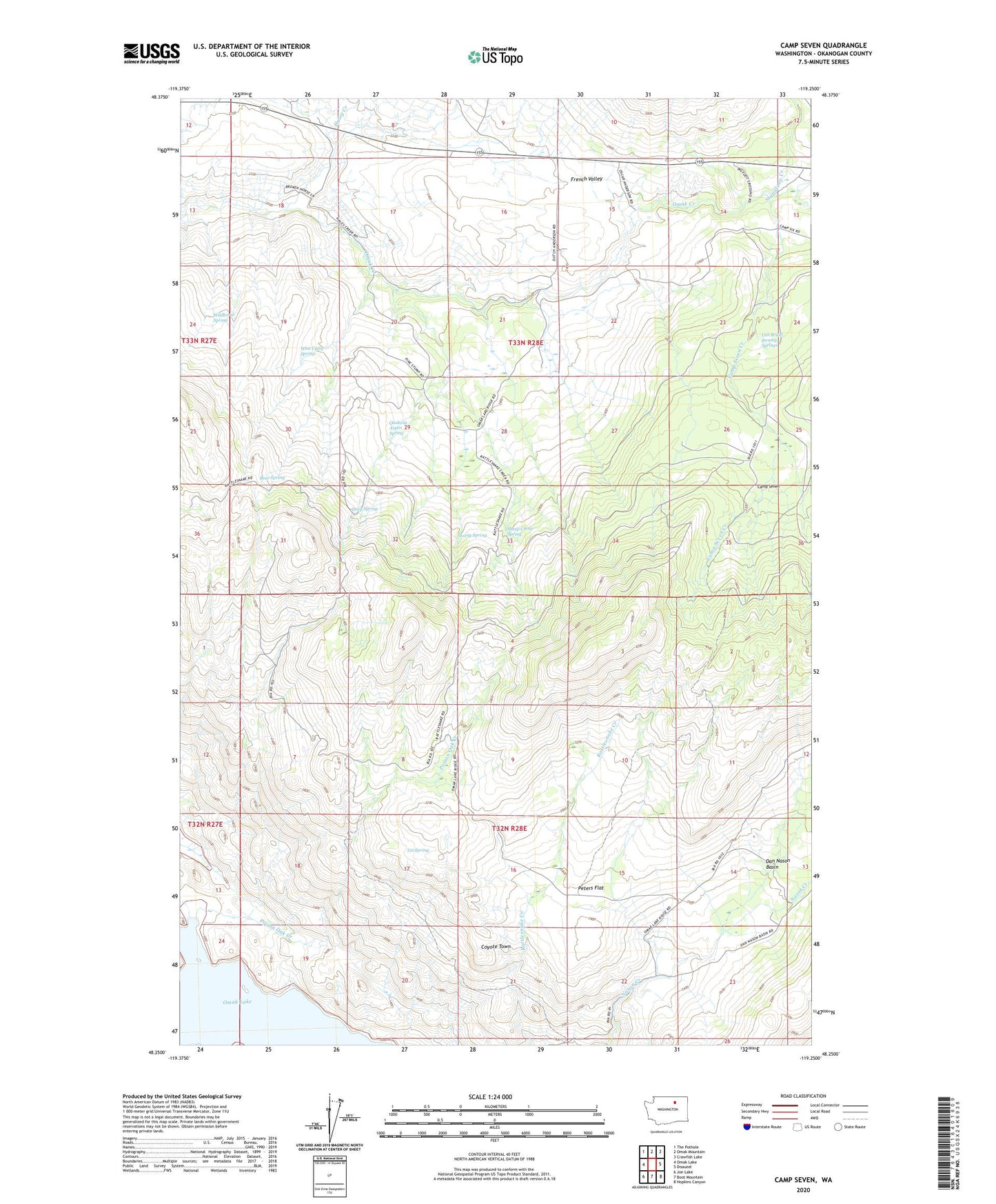
2023 topographic map quadrangle Camp Seven in the state of Washington. Scale: 1:24000. Based on the newly updated USGS 7.5' US Topo map series, this map is in the following counties: Okanogan. The map contains contour data, water features, and other items you are used to seeing on USGS maps, but also has updated roads and other features. This is the next generation of topographic maps. Printed on high-quality waterproof paper with UV fade-resistant inks.
Quads adjacent to this one:
West: Omak Lake
Northwest: The Pothole
North: Omak Mountain
Northeast: Crawfish Lake
East: Disautel
Southeast: Hopkins Canyon
South: Boot Mountain
Southwest: Joe Lake
This map covers the same area as the classic USGS quad with code o48119c3.
Contains the following named places: Bear Spring, Camp Progress, Camp Seven, Camp Seven Creek, Coyote Town, Deep Spring, Haley Creek, Peters Flat, Poison Oak Creek, Quaking Aspen Spring, Sheep Camp Spring, Shorty Spring, Stapaloop Creek, Tin Spring, Van Brunt Swamp Springs, Wildhorse Spring, Wise Camp Spring, ZIP Code: 98841