MyTopo
Stubblefield Point Washington US Topo Map
Couldn't load pickup availability
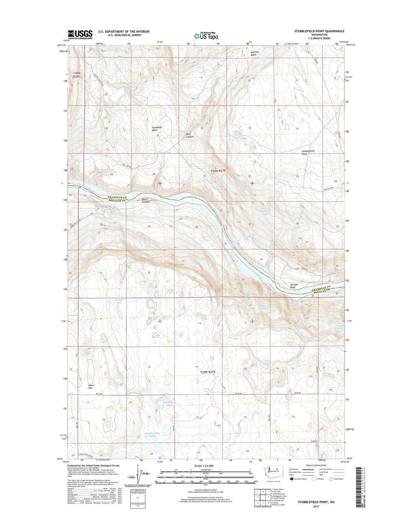
2023 topographic map quadrangle Stubblefield Point in the state of Washington. Scale: 1:24000. Based on the newly updated USGS 7.5' US Topo map series, this map is in the following counties: Douglas, Okanogan. The map contains contour data, water features, and other items you are used to seeing on USGS maps, but also has updated roads and other features. This is the next generation of topographic maps. Printed on high-quality waterproof paper with UV fade-resistant inks.
Quads adjacent to this one:
West: Bridgeport Point
Northwest: White Lakes
North: Joe Lake
Northeast: Boot Mountain
East: Trefry Canyon
Southeast: Foster Coulee
South: Leahy
Southwest: Coleman Hill
This map covers the same area as the classic USGS quad with code o48119a4.
Contains the following named places: Achimin Basin, Box Canyon, Bryan Springs, Connors Spring, Duley Lake, Eagle Rapids, Gaviota Bend, Gladys Spring, Judson Lake, Klinkhammer Lakes, Lenner Spring, Lone Pine Lake, Long Rapids, Miller Spring, Murphy Lake, Nilles Corner, Pearl, Ragged Butte School, Rice Canyon, Rilette Spring, Round Spring, Stubblefield Point, Tumwater Basin, Tumwater Creek, Vaughn Spring, White Cap Rapids