MyTopo
Broadax Draw Washington US Topo Map
Couldn't load pickup availability
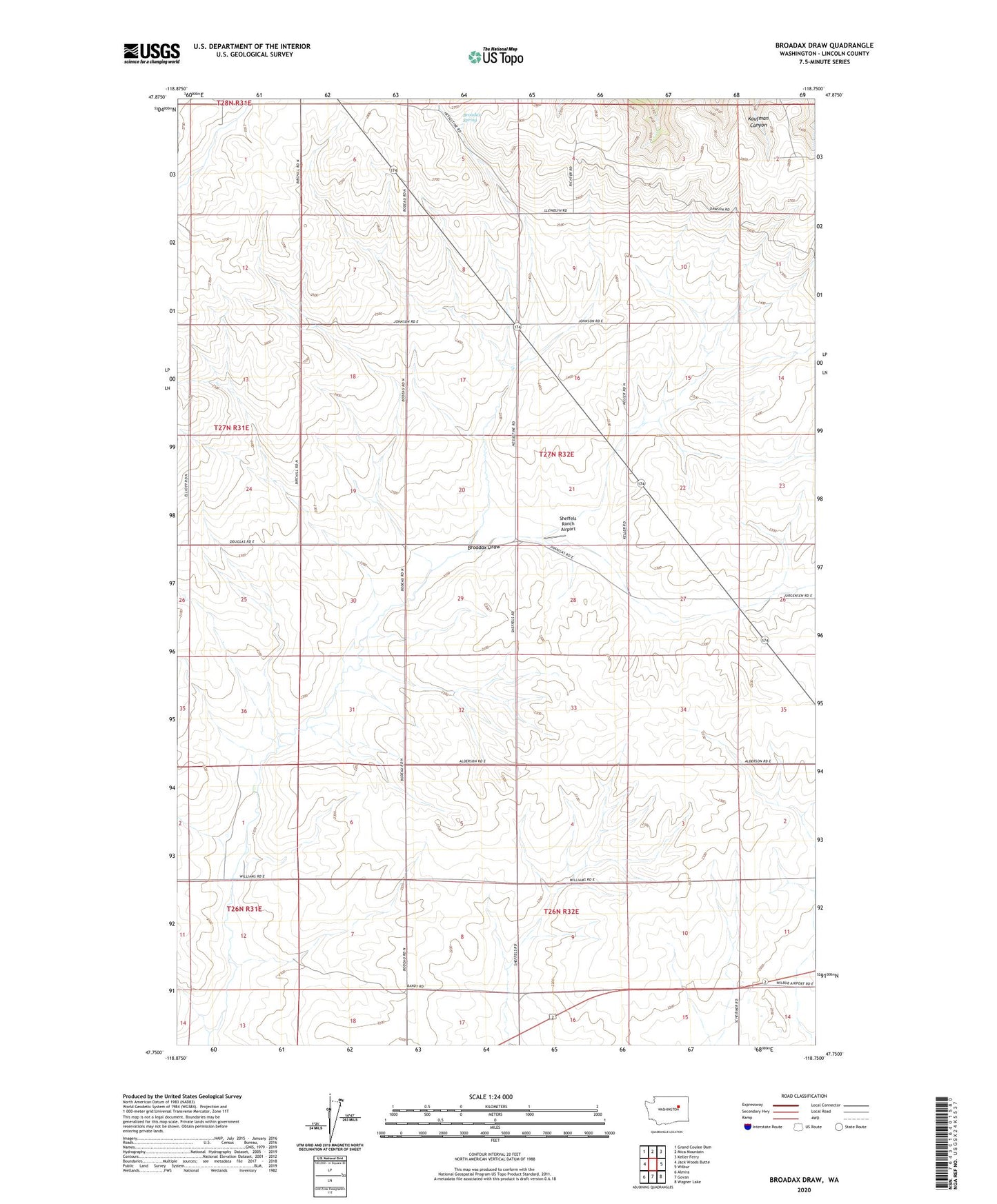
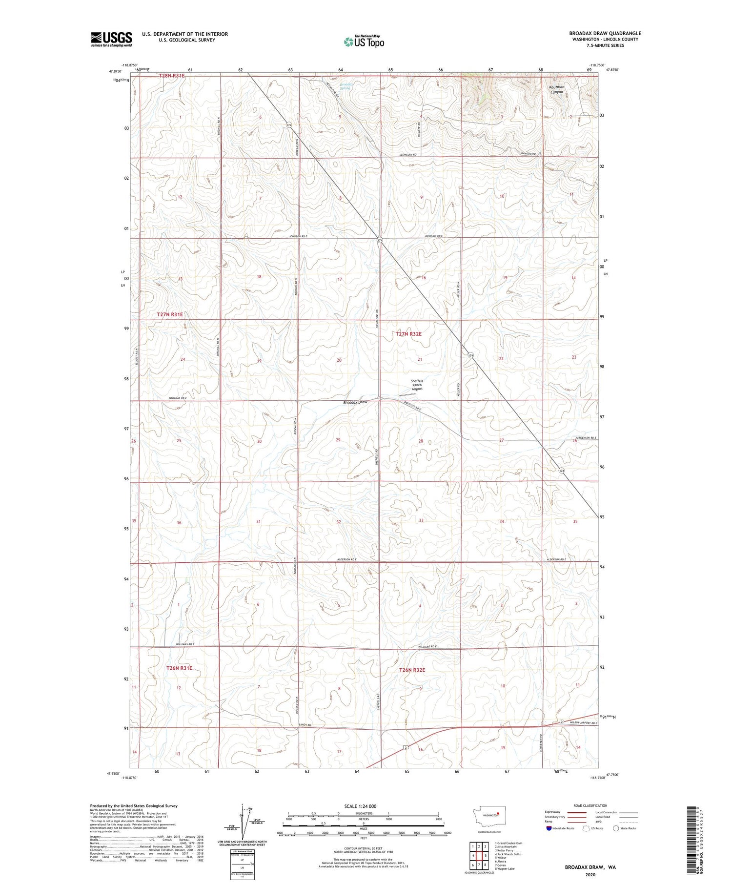
2020 topographic map quadrangle Broadax Draw in the state of Washington. Scale: 1:24000. Based on the newly updated USGS 7.5' US Topo map series, this map is in the following counties: Lincoln. The map contains contour data, water features, and other items you are used to seeing on USGS maps, but also has updated roads and other features. This is the next generation of topographic maps. Printed on high-quality waterproof paper with UV fade-resistant inks.
Quads adjacent to this one:
West: Jack Woods Butte
Northwest: Grand Coulee Dam
North: Mica Mountain
Northeast: Keller Ferry
East: Wilbur
Southeast: Wagner Lake
South: Govan
Southwest: Almira
Contains the following named places: Broadax Draw, Broadax Spring, Hesseltine, Sheffels Ranch Airport, Williams Grove Landing Strip