MyTopo
Grand Coulee Dam Washington US Topo Map
Couldn't load pickup availability
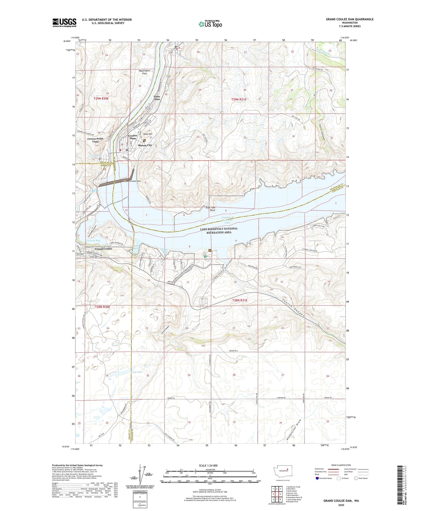
2023 topographic map quadrangle Grand Coulee Dam in the state of Washington. Scale: 1:24000. Based on the newly updated USGS 7.5' US Topo map series, this map is in the following counties: Lincoln, Okanogan, Grant, Douglas. The map contains contour data, water features, and other items you are used to seeing on USGS maps, but also has updated roads and other features. This is the next generation of topographic maps. Printed on high-quality waterproof paper with UV fade-resistant inks.
Quads adjacent to this one:
West: Electric City
Northwest: Sanderson Creek
North: Belvedere
Northeast: Keller Butte
East: Mica Mountain
Southeast: Broadax Draw
South: Jack Woods Butte
Southwest: Steamboat Rock SE
This map covers the same area as the classic USGS quad with code o47118h8.
Contains the following named places: Central School, Cole Park, Columbia Elementary School, Coulee Dam, Coulee Dam Community Church, Coulee Dam Fire Department, Coulee Dam Police Department, Coulee Dam Post Office, Coulee Dam Seaplane Base, Crescent Bay, Crown Point State Park, Crown Point Vista, Douglas Park, East Heights, Eden Harbor, Elmer City, Elmer City Post Office, Fiddle Creek, Gibbs Bay, Grand Coulee Dam, Greene Memorial Field, Hells Canyon, KEYG-AM (Grand Coulee), KEYG-FM (Grand Coulee), Lake Roosevelt National Recreation Area Headquarters, Lake Roosevelt Schools, Lone Pine, Long Lake, Mason City, Mead Park, Okanogan County Fire District 2, Pine Tree Point, Rattlesnake Canyon, Sand Hill, Seaton Canyon, Spring Canyon, The Church of Jesus Christ of Latter Day Saints, Town of Coulee Dam, Town of Elmer City, Washington Flats, ZIP Code: 99124