MyTopo
Buckhorn Mountain Washington US Topo Map
Couldn't load pickup availability
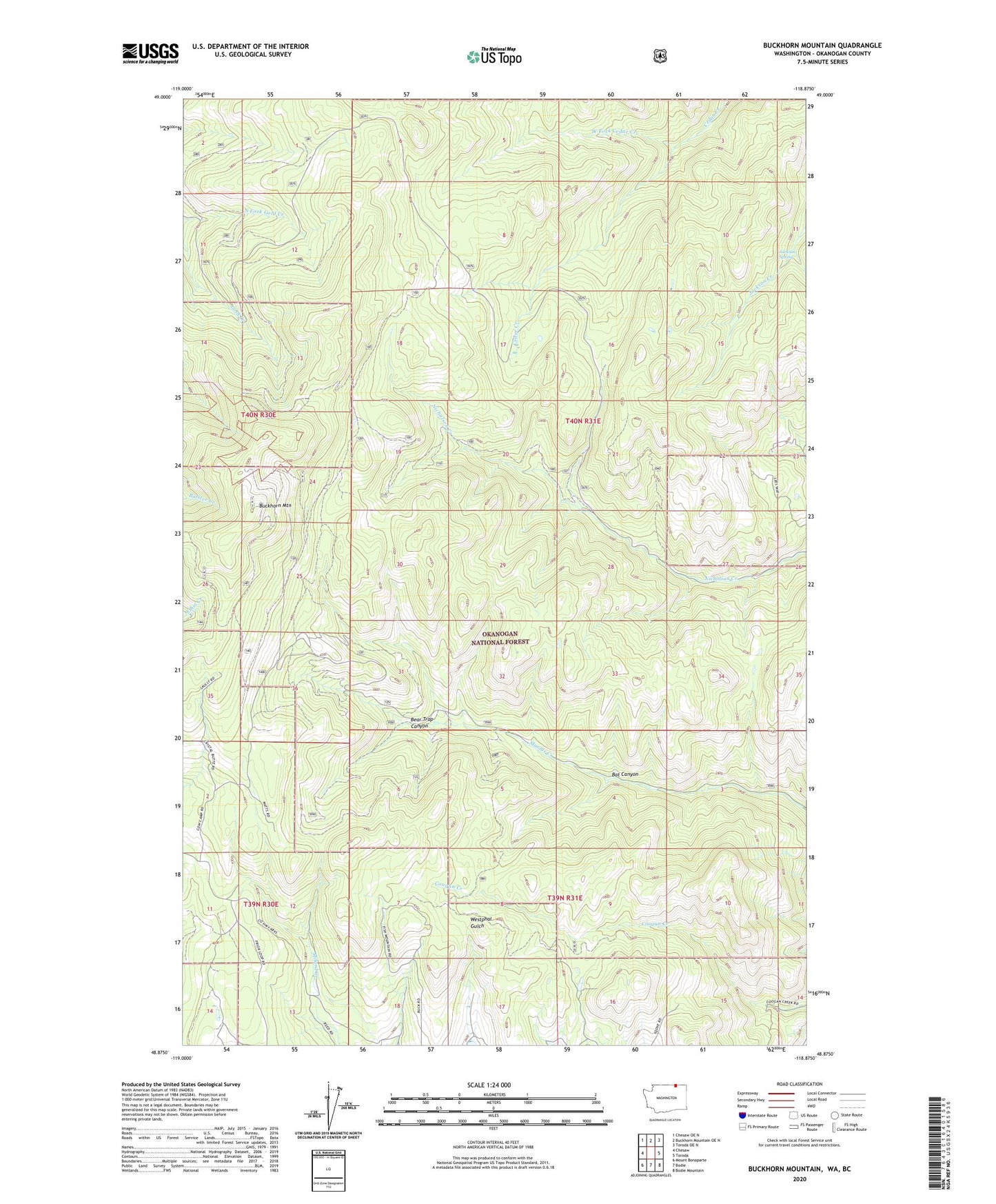
2020 topographic map quadrangle Buckhorn Mountain in the state of Washington. Scale: 1:24000. Based on the newly updated USGS 7.5' US Topo map series, this map is in the following counties: Okanogan. The map contains contour data, water features, and other items you are used to seeing on USGS maps, but also has updated roads and other features. This is the next generation of topographic maps. Printed on high-quality waterproof paper with UV fade-resistant inks.
Quads adjacent to this one:
West: Chesaw
Northwest: Chesaw OE N
North: Buckhorn Mountain OE N
Northeast: Toroda OE N
East: Toroda
Southeast: Bodie Mountain
South: Bodie
Southwest: Mount Bonaparte
Contains the following named places: Bat Canyon, Bear Trap Canyon, Buckhorn Mountain, Cedar Creek, Cow Camp Corral, Denney Trail, Fawns Mill Trail, Gold Axe Camp, Jackson Spring, Magnetic Mine, Marias Creek Trail, Roosevelt Camp, West Fork Cedar Creek