MyTopo
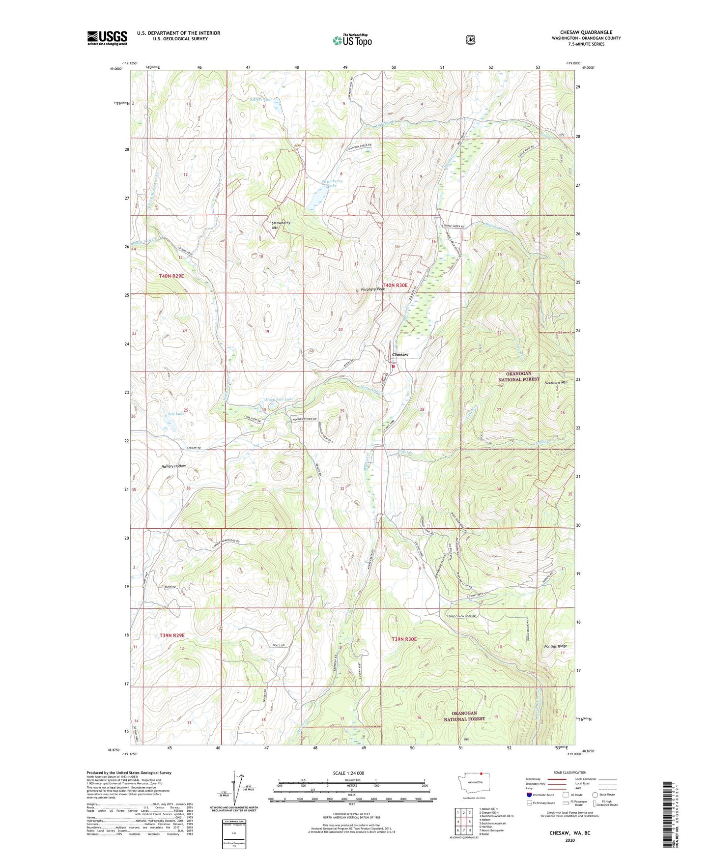
Chesaw Washington US Topo Map
Couldn't load pickup availability
Also explore the Chesaw Forest Service Topo of this same quad for updated USFS data
2023 topographic map quadrangle Chesaw in the state of Washington. Scale: 1:24000. Based on the newly updated USGS 7.5' US Topo map series, this map is in the following counties: Okanogan. The map contains contour data, water features, and other items you are used to seeing on USGS maps, but also has updated roads and other features. This is the next generation of topographic maps. Printed on high-quality waterproof paper with UV fade-resistant inks.
Quads adjacent to this one:
West: Molson
Northwest: Molson OE N
North: Chesaw OE N
Northeast: Buckhorn Mountain OE N
East: Buckhorn Mountain
Southeast: Bodie
South: Mount Bonaparte
Southwest: Havillah
This map covers the same area as the classic USGS quad with code o48119h1.
Contains the following named places: Ads Lake, Bolster, Bolster Creek, Chesaw, Ethel Creek, Gafvery Creek, Gold Creek, Hungry Hollow, Lime Creek, Mary Ann Creek, Mary Ann Lake, North Fork Gold Creek, North Fork Mary Ann Creek, Okanogan County Fire District 11 Chesaw, Poland China Mine, Pontiac Ridge, Porphyry Peak, Strawberry Lake, Strawberry Mountain, Thorp Creek, Walker Lake