MyTopo
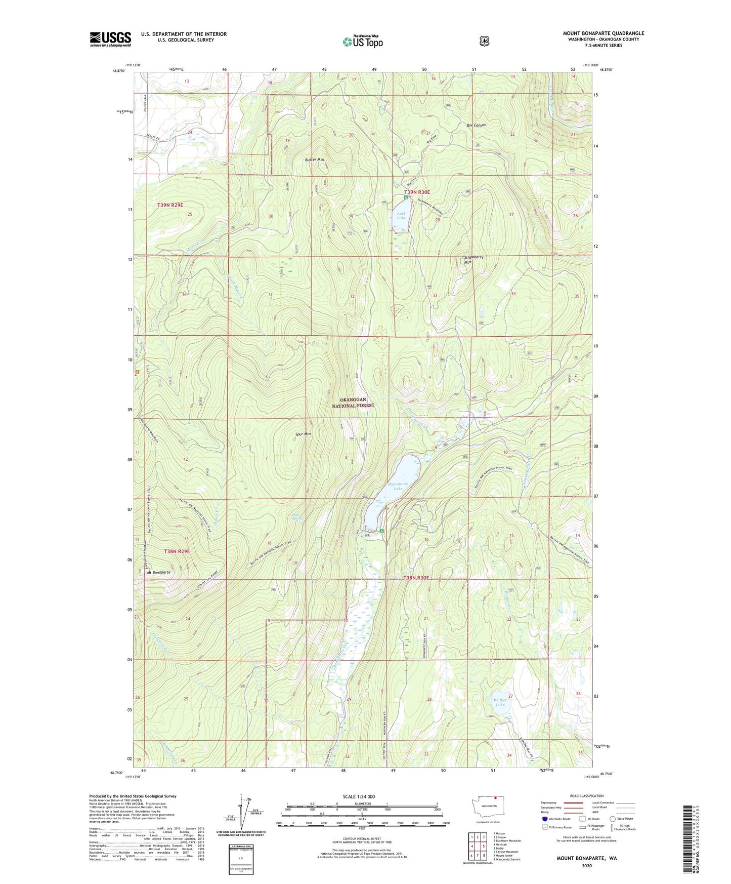
Mount Bonaparte Washington US Topo Map
Couldn't load pickup availability
Also explore the Mount Bonaparte Forest Service Topo of this same quad for updated USFS data
2023 topographic map quadrangle Mount Bonaparte in the state of Washington. Scale: 1:24000. Based on the newly updated USGS 7.5' US Topo map series, this map is in the following counties: Okanogan. The map contains contour data, water features, and other items you are used to seeing on USGS maps, but also has updated roads and other features. This is the next generation of topographic maps. Printed on high-quality waterproof paper with UV fade-resistant inks.
Quads adjacent to this one:
West: Havillah
Northwest: Molson
North: Chesaw
Northeast: Buckhorn Mountain
East: Bodie
Southeast: Wauconda Summit
South: Mount Annie
Southwest: Cayuse Mountain
This map covers the same area as the classic USGS quad with code o48119g1.
Contains the following named places: Beaver Ridge Trail, Big Tree Botanical Area, Bonaparta Lake Dam, Bonaparte Campground, Bonaparte Lake, Bonaparte Trail, Buster Mountain, Camp Ortoha, Camp Tokiwanee, Duff Spring, East Fork Myers Creek, Lost Lake, Lost Lake Campground, Mount Bonaparte, Mount Bonaparte Lookout, Pettijohn Creek, South Side Trail, Spur Mountain, Strawberry Mountain, Walker Lake