MyTopo
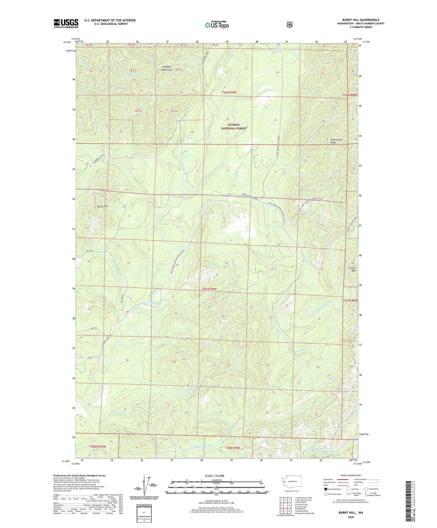
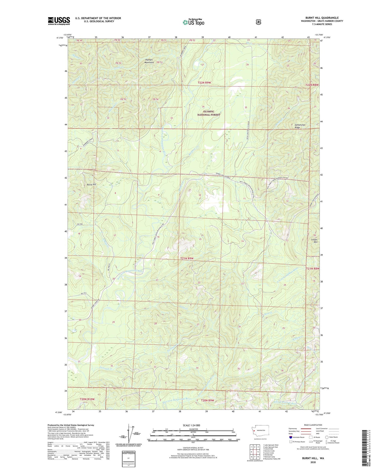
Burnt Hill Washington US Topo Map
Couldn't load pickup availability
2020 topographic map quadrangle Burnt Hill in the state of Washington. Scale: 1:24000. Based on the newly updated USGS 7.5' US Topo map series, this map is in the following counties: Grays Harbor. The map contains contour data, water features, and other items you are used to seeing on USGS maps, but also has updated roads and other features. This is the next generation of topographic maps. Printed on high-quality waterproof paper with UV fade-resistant inks.
Quads adjacent to this one:
West: Stevens Creek
Northwest: Lake Quinault West
North: Lake Quinault East
Northeast: Colonel Bob
East: Larsen Creek
Southeast: Wynoochee Valley NW
South: Railroad Camp
Southwest: Humptulips
Contains the following named places: Burnt Hill, Donkey Creek, Elk Creek, Furlough Creek, Grouse Creek, Humptulips Guard Station, Humptulips Ridge Lookout, Jones Creek, Newbury Creek, O'Brien Creek, Rainbow Creek, Rock Creek, Township 21-9, Webfoot Creek