MyTopo
Humptulips Washington US Topo Map
Couldn't load pickup availability
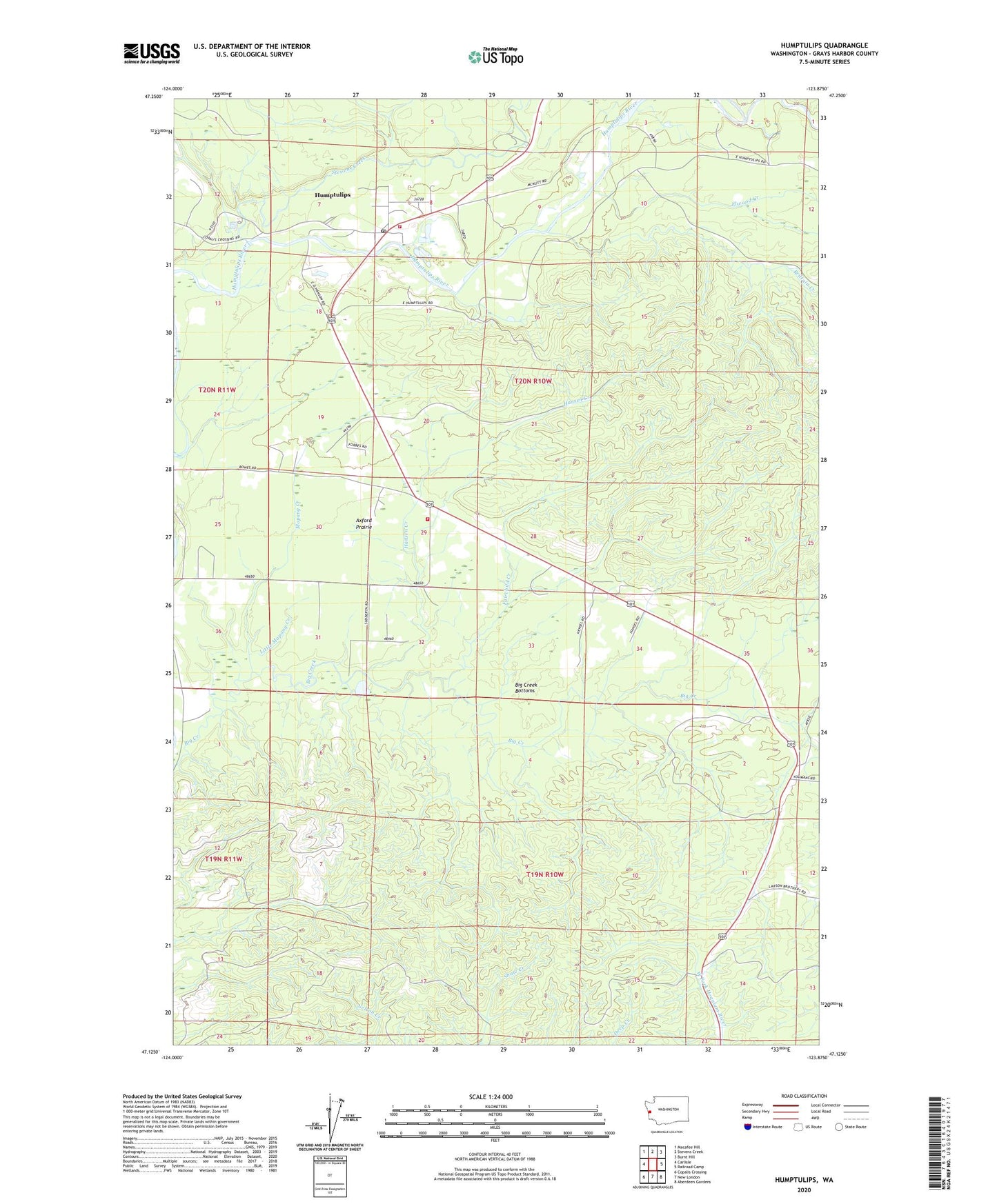
2023 topographic map quadrangle Humptulips in the state of Washington. Scale: 1:24000. Based on the newly updated USGS 7.5' US Topo map series, this map is in the following counties: Grays Harbor. The map contains contour data, water features, and other items you are used to seeing on USGS maps, but also has updated roads and other features. This is the next generation of topographic maps. Printed on high-quality waterproof paper with UV fade-resistant inks.
Quads adjacent to this one:
West: Carlisle
Northwest: Macafee Hill
North: Stevens Creek
Northeast: Burnt Hill
East: Railroad Camp
Southeast: Aberdeen Gardens
South: New London
Southwest: Copalis Crossing
This map covers the same area as the classic USGS quad with code o47123b8.
Contains the following named places: Axford, Axford Prairie, Big Creek Bottoms, Brittain Creek, East Fork Humptulips River, Elwood Creek, Fairchild Creek, Grays Harbor Fire District 17 Station 1, Grays Harbor Fire District 17 Station 2, Hansen Creek, Humptulips, Humptulips Census Designated Place, Humptulips Division, Humptulips Gravel Quarry, Humptulips Post Office, Little Mopang Creek, Mopang Creek, South Branch Big Creek, Stevens Creek, West Fork Humptulips River