MyTopo
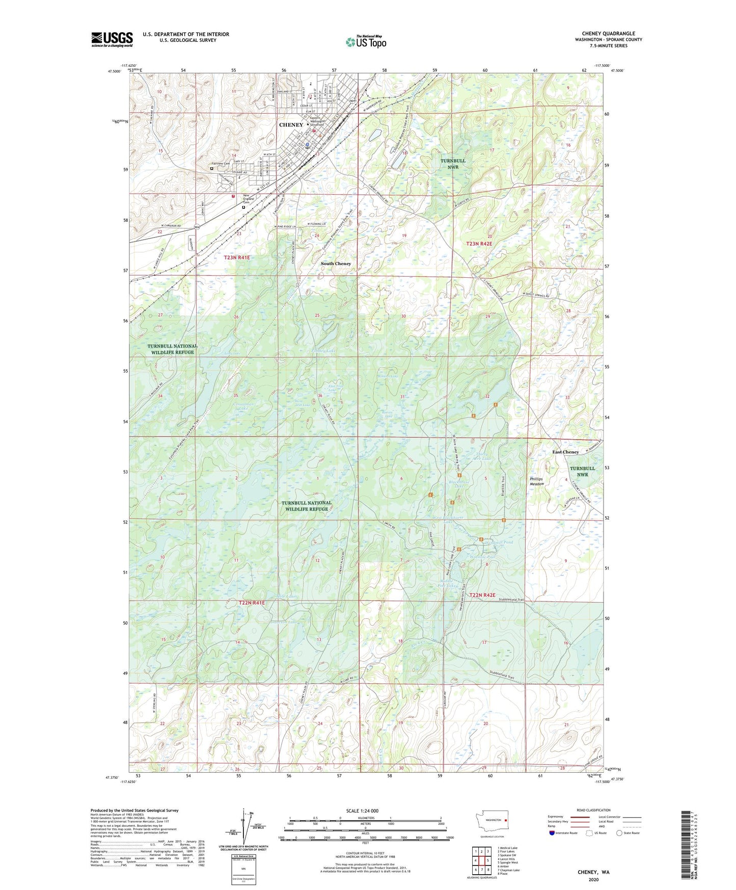
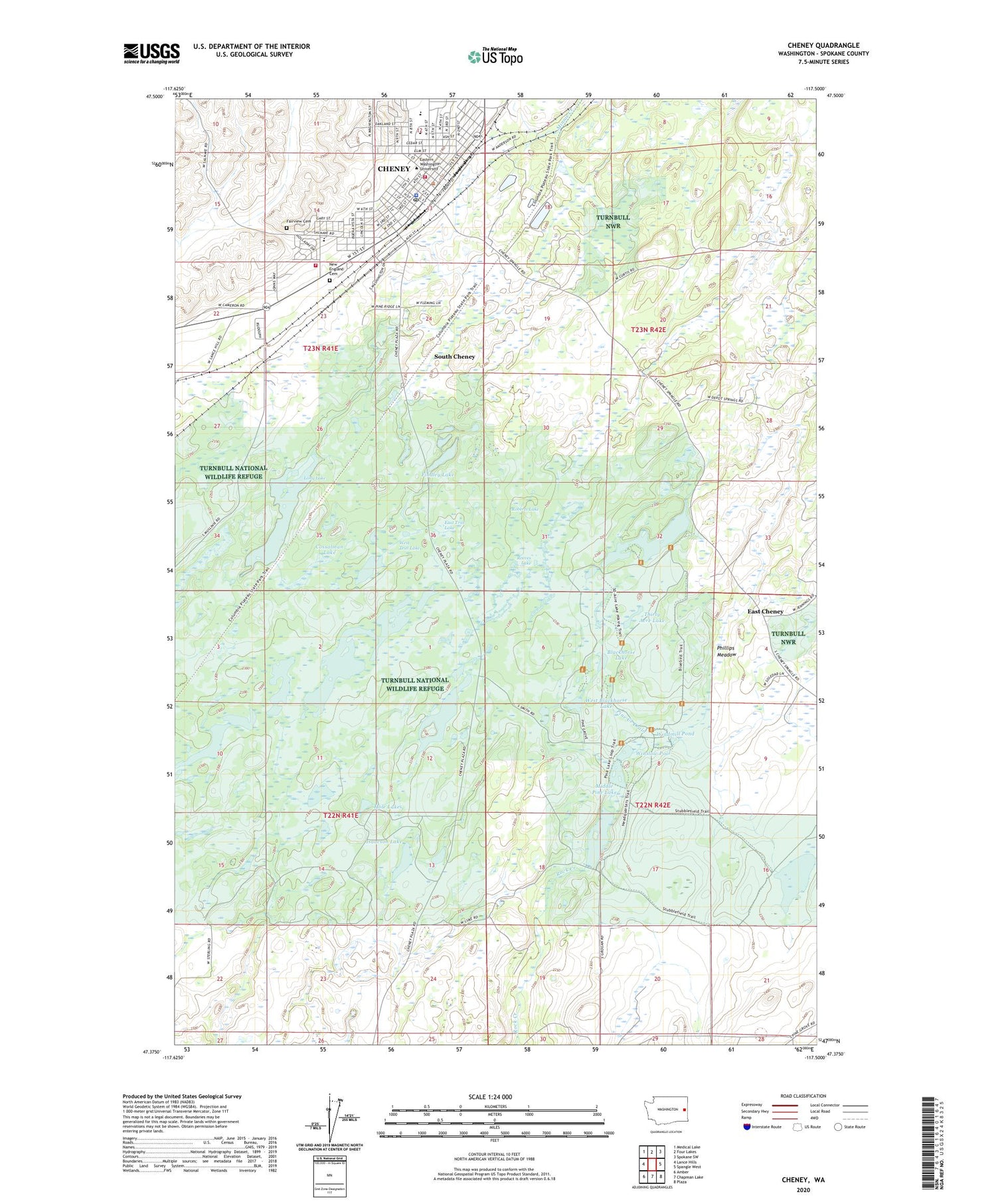
Cheney Washington US Topo Map
Couldn't load pickup availability
2020 topographic map quadrangle Cheney in the state of Washington. Scale: 1:24000. Based on the newly updated USGS 7.5' US Topo map series, this map is in the following counties: Spokane. The map contains contour data, water features, and other items you are used to seeing on USGS maps, but also has updated roads and other features. This is the next generation of topographic maps. Printed on high-quality waterproof paper with UV fade-resistant inks.
Quads adjacent to this one:
West: Lance Hills
Northwest: Medical Lake
North: Four Lakes
Northeast: Spokane SW
East: Spangle West
Southeast: Plaza
South: Chapman Lake
Southwest: Amber
Contains the following named places: Amber-Cheney South Division, Betz Elementary School, Blackhorse Lake, Cheney, Cheney Fire Department, Cheney Flour Mill, Cheney High School, Cheney Police Department, Cheney Post Office, City of Cheney, Cossalman Lake, East Cheney, East Tritt Lake, Eastern Washington University, Emtman Dam Number One, Emtman Dam Number Two, Fairview Cemetery, Findley Lake, Hole Lakes, Isaacson Lake, Kepple Lake, Lasher Lake, Long Lake, Lower Pine Lake, Lower Pine Lake Dam, McDowell Lake, Middle Pine Dike Dam, Middle Pine Lake, New England Cemetery, Phillips Meadow, Pine Creek Drain, Pine Lakes, Red Barn, Reeves Lake, Robert Reid Elementary School, Roberts Lake, Salnave Elementary School, Salnave Park, South Cheney, Spokane County Fire District 3 Station 31 Cheney, Stubblefield Lake, Sutton Park, Thirty Acre Lake, Turnbull National Wildlife Refuge, Turnbull Slough, West Blackhorse Lake, West Tritt Lake, Windmill Pond, Winslow Dike Dam, Winslow Pool