MyTopo
Spangle West Washington US Topo Map
Couldn't load pickup availability
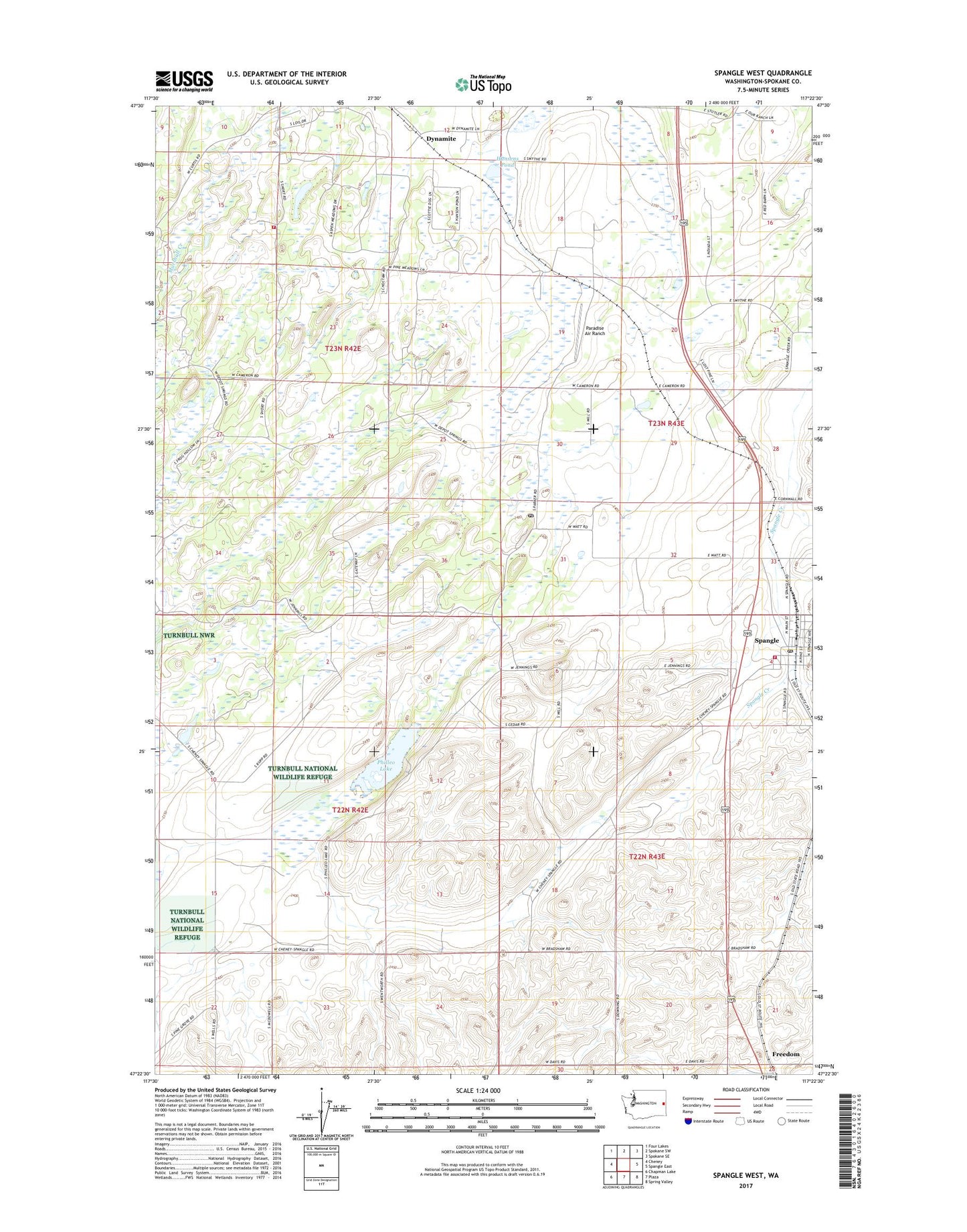
2023 topographic map quadrangle Spangle West in the state of Washington. Scale: 1:24000. Based on the newly updated USGS 7.5' US Topo map series, this map is in the following counties: Spokane. The map contains contour data, water features, and other items you are used to seeing on USGS maps, but also has updated roads and other features. This is the next generation of topographic maps. Printed on high-quality waterproof paper with UV fade-resistant inks.
Quads adjacent to this one:
West: Cheney
Northwest: Four Lakes
North: Spokane SW
Northeast: Spokane SE
East: Spangle East
Southeast: Spring Valley
South: Plaza
Southwest: Chapman Lake
This map covers the same area as the classic USGS quad with code o47117d4.
Contains the following named places: City of Spangle, Dynamite, Freedom, Hansens Pond, Paradise Air Ranch, Philleo Lake, Pine Grove Post Office, Spangle, Spangle Cemetery, Spangle Post Office, Spokane County Fire District 3 Station 36 Spangle, Spokane County Fire District 3 Station 37 - Aspen Meadows