MyTopo
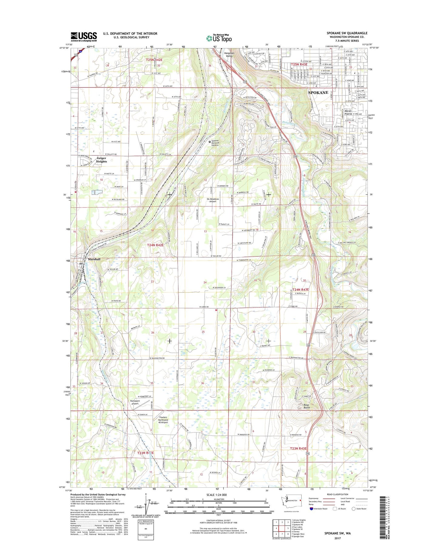
Spokane SW Washington US Topo Map
Couldn't load pickup availability
2023 topographic map quadrangle Spokane SW in the state of Washington. Scale: 1:24000. Based on the newly updated USGS 7.5' US Topo map series, this map is in the following counties: Spokane. The map contains contour data, water features, and other items you are used to seeing on USGS maps, but also has updated roads and other features. This is the next generation of topographic maps. Printed on high-quality waterproof paper with UV fade-resistant inks.
Quads adjacent to this one:
West: Four Lakes
Northwest: Airway Heights
North: Spokane NW
Northeast: Spokane NE
East: Spokane SE
Southeast: Spangle East
South: Spangle West
Southwest: Cheney
This map covers the same area as the classic USGS quad with code o47117e4.
Contains the following named places: All Saints Middle School, Comstock School, Cowles, Fowlers Northwest 40 Airport, Geiger Heights, Hamblen Elementary School, Hangman Valley, High Drive Parkway, Homeport Airport, Jefferson Elementary School, KCKO-AM (Spokane), KEYF-AM (Dishman), KJRB-AM (Spokane), KSPO-AM (Dishman), Magpie Flats Heliport, Manito Golf Country Club, Marshall, Marshall Creek, Marshall Post Office, Minnie Creek, Mullan Hill Airport, Mullan Military Road Historical Monument, Overlook, Ox Meadows Airport, Rosa Butte, Southside Montessori Elementary School, Spokane County, Spokane County Fire District 3 Station 34 Marshall, Spokane County Fire District 3 Station 35 Paradise, Spokane Memorial Gardens, Spokane South Division, Windsor Elementary School, ZIP Code: 99020