MyTopo
Christmas Creek Washington US Topo Map
Couldn't load pickup availability
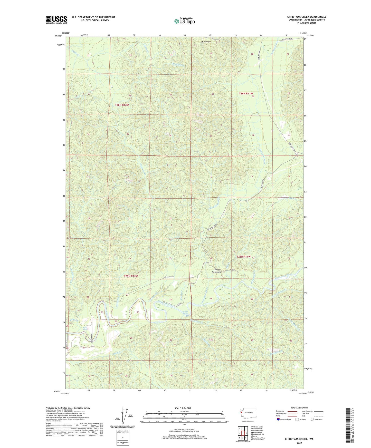
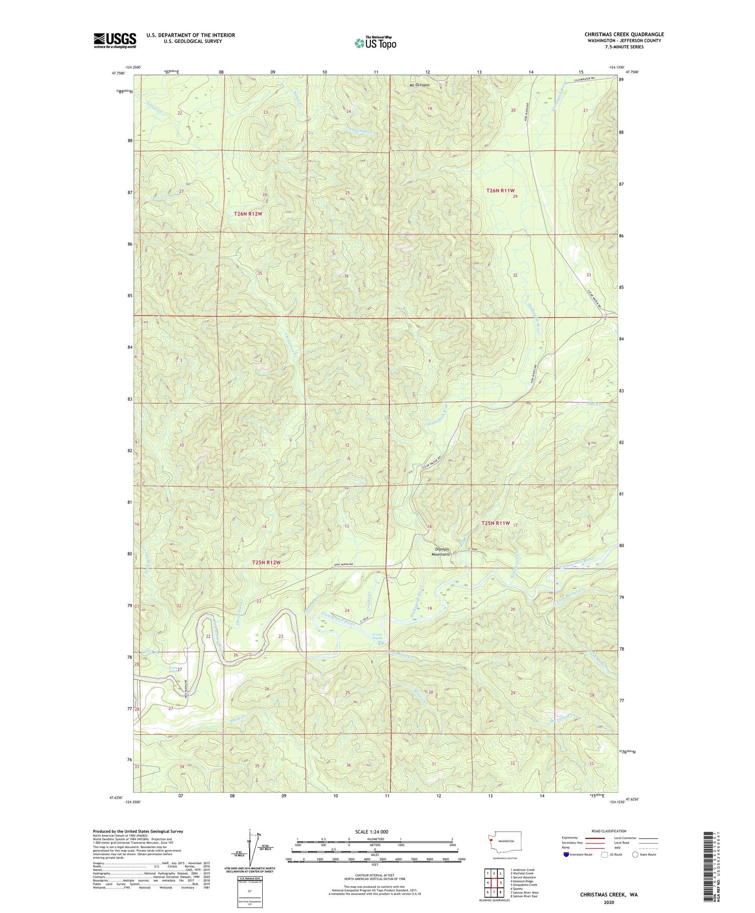
2020 topographic map quadrangle Christmas Creek in the state of Washington. Scale: 1:24000. Based on the newly updated USGS 7.5' US Topo map series, this map is in the following counties: Jefferson. The map contains contour data, water features, and other items you are used to seeing on USGS maps, but also has updated roads and other features. This is the next generation of topographic maps. Printed on high-quality waterproof paper with UV fade-resistant inks.
Quads adjacent to this one:
West: Kalaloch Ridge
Northwest: Anderson Creek
North: Winfield Creek
Northeast: Spruce Mountain
East: Stequaleho Creek
Southeast: Salmon River East
South: Salmon River West
Southwest: Queets
Contains the following named places: Bull Creek, Christmas Creek, Clearwater Honor Camp, Copper Mine Botton Campground, Crooks Creek, Crooks Rapids, Deception Creek, East Fork Miller Creek, Manor Creek, Miller Creek, Mount Octopus, North Fork Manor Creek, Olympic Correctional Center, Olympic Correctional Center Wastewater Treatment Plant, Peterson Creek, Prairie Creek, Rocky Rapids, Snahapish River, South Fork Manor Creek, Willamaud Creek