MyTopo
Spruce Mountain Washington US Topo Map
Couldn't load pickup availability
Also explore the Spruce Mountain Forest Service Topo of this same quad for updated USFS data
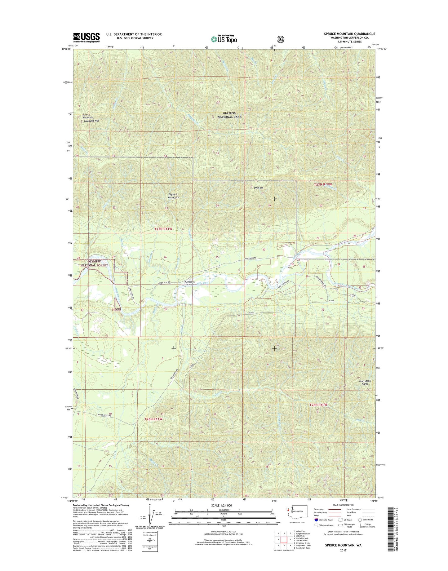
2023 topographic map quadrangle Spruce Mountain in the state of Washington. Scale: 1:24000. Based on the newly updated USGS 7.5' US Topo map series, this map is in the following counties: Jefferson. The map contains contour data, water features, and other items you are used to seeing on USGS maps, but also has updated roads and other features. This is the next generation of topographic maps. Printed on high-quality waterproof paper with UV fade-resistant inks.
Quads adjacent to this one:
West: Winfield Creek
Northwest: Indian Pass
North: Hunger Mountain
Northeast: Slide Peak
East: Owl Mountain
Southeast: Kloochman Rock
South: Stequaleho Creek
Southwest: Christmas Creek
This map covers the same area as the classic USGS quad with code o47124g1.
Contains the following named places: Bogachiel-Hoh Trail, Canyon Creek, Dismal Creek, Dry Creek, Geodetic Hill, Huelsdonk Bridge, Huelsdonk Campground, Huelsdonk Ranch, Lewis Ranch, Maple Creek, Owl Creek, Peak Six, Pole Creek, South Fork Hoh River, South Fork Owl Creek, Spruce Creek, Spruce Mountain, Tower Creek