MyTopo
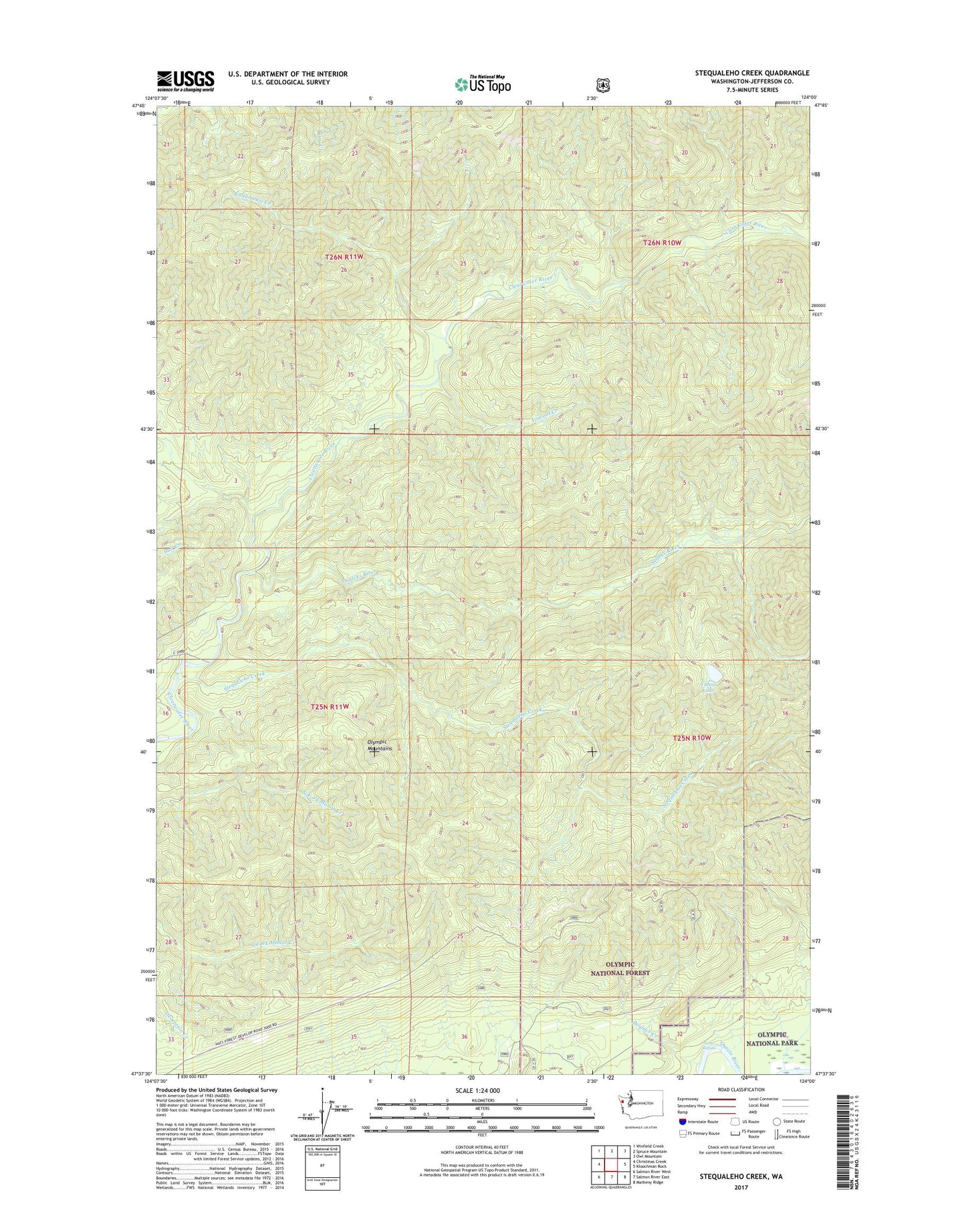
Stequaleho Creek Washington US Topo Map
Couldn't load pickup availability
Also explore the Stequaleho Creek Forest Service Topo of this same quad for updated USFS data
2023 topographic map quadrangle Stequaleho Creek in the state of Washington. Scale: 1:24000. Based on the newly updated USGS 7.5' US Topo map series, this map is in the following counties: Jefferson. The map contains contour data, water features, and other items you are used to seeing on USGS maps, but also has updated roads and other features. This is the next generation of topographic maps. Printed on high-quality waterproof paper with UV fade-resistant inks.
Quads adjacent to this one:
West: Christmas Creek
Northwest: Winfield Creek
North: Spruce Mountain
Northeast: Owl Mountain
East: Kloochman Rock
Southeast: Matheny Ridge
South: Salmon River East
Southwest: Salmon River West
This map covers the same area as the classic USGS quad with code o47124f1.
Contains the following named places: Boulder Creek, Itswoot Creek, Kunamakst Creek, Queets Campground, Sams Rapids, Solleks River, Stequaleho Creek, Upper Clearwater Campground, West End Division, Yahoo Lake, Yahoo Lake Campground