MyTopo
Anderson Creek Washington US Topo Map
Couldn't load pickup availability
Also explore the Anderson Creek Forest Service Topo of this same quad for updated USFS data
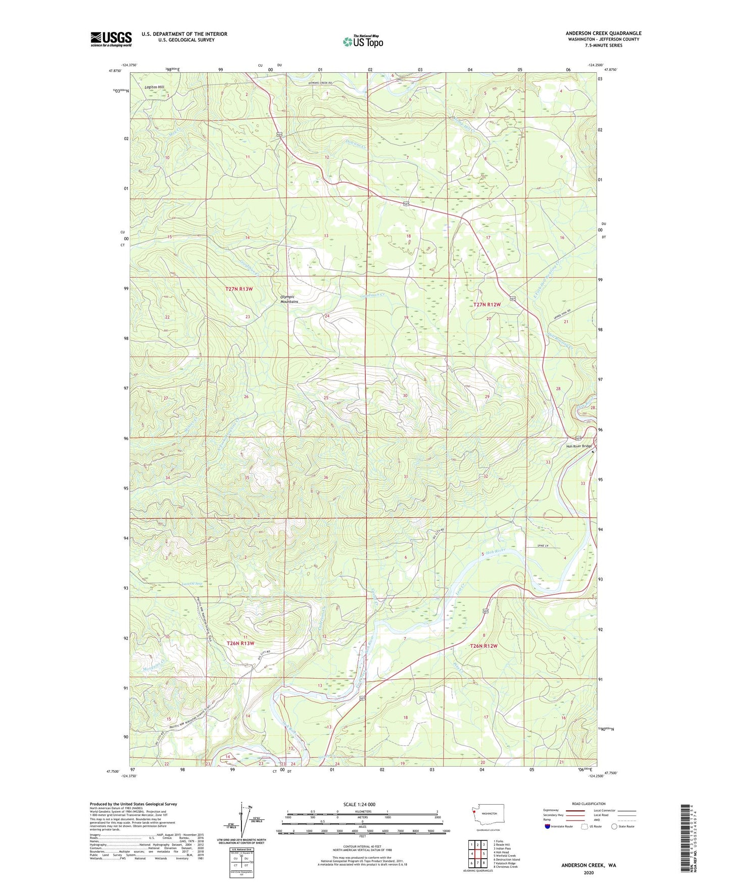
2023 topographic map quadrangle Anderson Creek in the state of Washington. Scale: 1:24000. Based on the newly updated USGS 7.5' US Topo map series, this map is in the following counties: Jefferson. The map contains contour data, water features, and other items you are used to seeing on USGS maps, but also has updated roads and other features. This is the next generation of topographic maps. Printed on high-quality waterproof paper with UV fade-resistant inks.
Quads adjacent to this one:
West: Hoh Head
Northwest: Forks
North: Reade Hill
Northeast: Indian Pass
East: Winfield Creek
Southeast: Christmas Creek
South: Kalaloch Ridge
Southwest: Destruction Island
This map covers the same area as the classic USGS quad with code o47124g3.
Contains the following named places: Anderson Creek, Cassel Creek, Cassel School, Cottonwood Campground, Dowans Creek, East Fork Hell Roaring Creek, Hell Roaring Creek, Hemp Hill Creek, Hoh Ox Bow Campground, Hoh River Bridge, Lacy Oil Seep, Lagitos Hill, Lost Creek, Lower Hoh Fire Camp, Nolan Creek, Pins, Pins Creek