
MyTopo
Columbia Point Washington US Topo Map
Couldn't load pickup availability
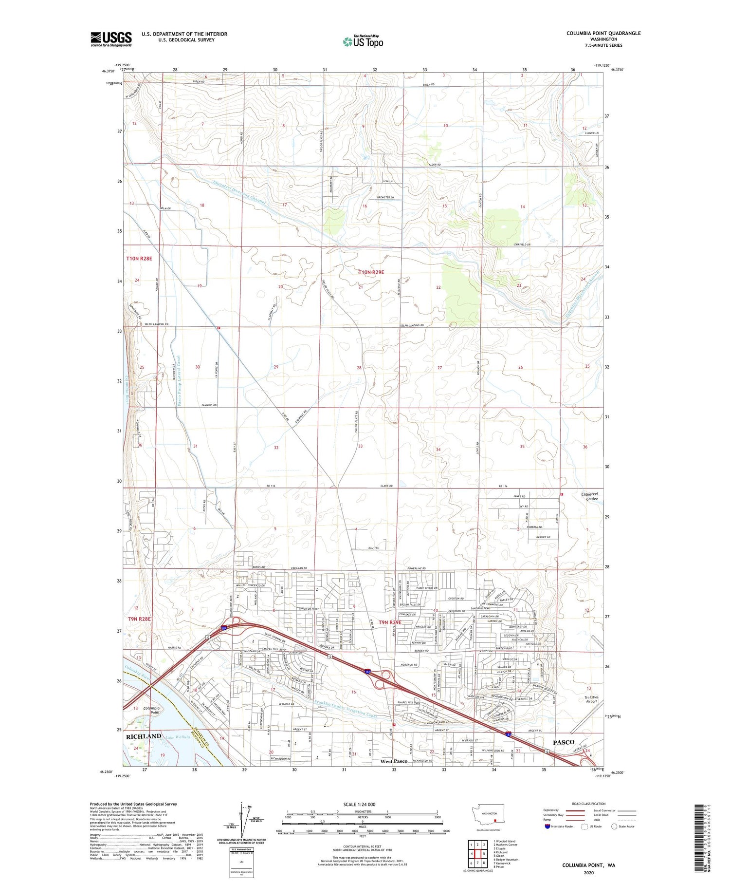
2020 topographic map quadrangle Columbia Point in the state of Washington. Scale: 1:24000. Based on the newly updated USGS 7.5' US Topo map series, this map is in the following counties: Franklin, Benton. The map contains contour data, water features, and other items you are used to seeing on USGS maps, but also has updated roads and other features. This is the next generation of topographic maps. Printed on high-quality waterproof paper with UV fade-resistant inks.
Quads adjacent to this one:
West: Richland
Northwest: Wooded Island
North: Mathews Corner
Northeast: Eltopia
East: Glade
Southeast: Pasco
South: Kennewick
Southwest: Badger Mountain
Contains the following named places: Bateman Island, City of Pasco, Columbia Point, Esquatzel Diversion Channel, Franklin County Fire District 3 Station 33, Franklin County Fire District 3 Station 36, Franklin County Irrigation Canal, Iglesia Bautista de Riverview, James McGee Elementary School, McLoughlin Middle School, Pasco Fire Department / Ambulance Service Station 83, Pasco Pump Lateral Canal, Ruth Livingston Elementary School, Sunset View Baptist Church, West Pasco Census Designated Place, Yakima River


