MyTopo
Glade Washington US Topo Map
Couldn't load pickup availability
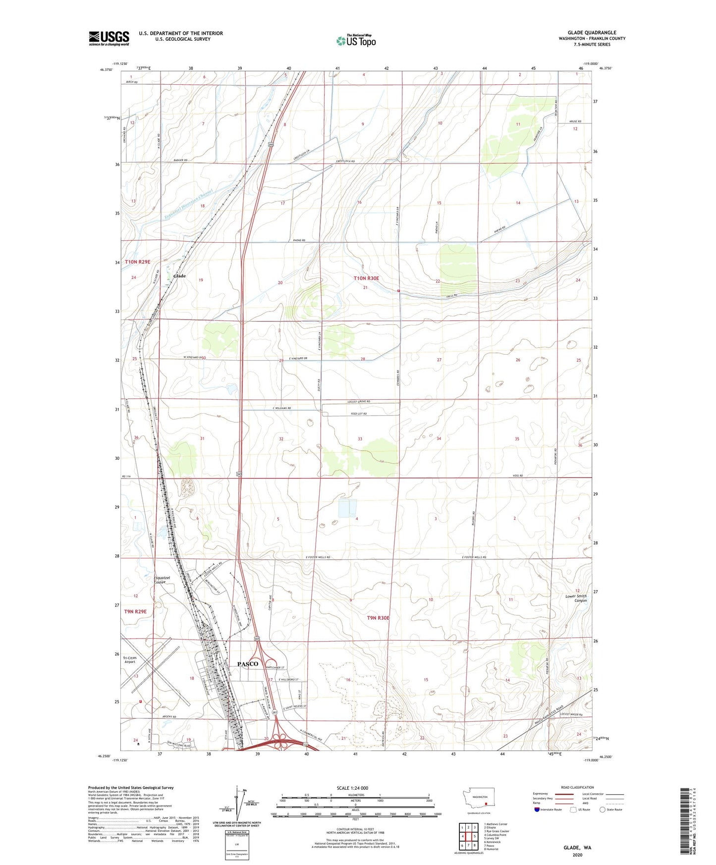
2023 topographic map quadrangle Glade in the state of Washington. Scale: 1:24000. Based on the newly updated USGS 7.5' US Topo map series, this map is in the following counties: Franklin. The map contains contour data, water features, and other items you are used to seeing on USGS maps, but also has updated roads and other features. This is the next generation of topographic maps. Printed on high-quality waterproof paper with UV fade-resistant inks.
Quads adjacent to this one:
West: Columbia Point
Northwest: Mathews Corner
North: Eltopia
Northeast: Rye Grass Coulee
East: Levey SW
Southeast: Humorist
South: Pasco
Southwest: Kennewick
This map covers the same area as the classic USGS quad with code o46119c1.
Contains the following named places: Columbia Basin College, Esquatzel Coulee, Franklin County Fire District 3 Station 35, Glade, Naval Air Station Pasco, New Horizon High School, Pasco Fire Department / Ambulance Service Station 82 Airport, Pasco Kindergarten, Tri-Cities Airport