MyTopo
Connell Washington US Topo Map
Couldn't load pickup availability
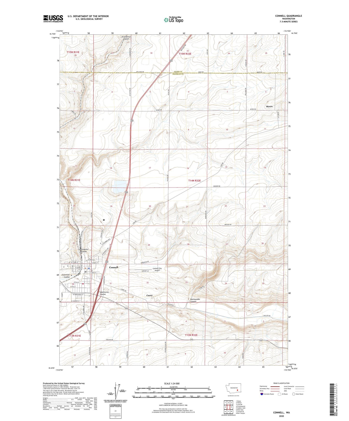
2023 topographic map quadrangle Connell in the state of Washington. Scale: 1:24000. Based on the newly updated USGS 7.5' US Topo map series, this map is in the following counties: Franklin, Adams. The map contains contour data, water features, and other items you are used to seeing on USGS maps, but also has updated roads and other features. This is the next generation of topographic maps. Printed on high-quality waterproof paper with UV fade-resistant inks.
Quads adjacent to this one:
West: Frischknecht
Northwest: Shano
North: Hatton
Northeast: Lind SW
East: Sulphur Lake
Southeast: Burr Canyon
South: Connell SE
Southwest: Mesa East
This map covers the same area as the classic USGS quad with code o46118f7.
Contains the following named places: City of Connell, Connell, Connell City Airport, Connell Elementary School, Connell Fire Department, Connell Police Department, Connell Post Office, Connell Senior High School, Coyote Ridge Corrections Center, Curry, Emery, Myers, Pioneer Park, Providence Coulee, Rattlesnake Canyon, Robert L Olds Junior High School, Striker Park, ZIP Code: 99326