MyTopo
Copper Mountain Washington US Topo Map
Couldn't load pickup availability
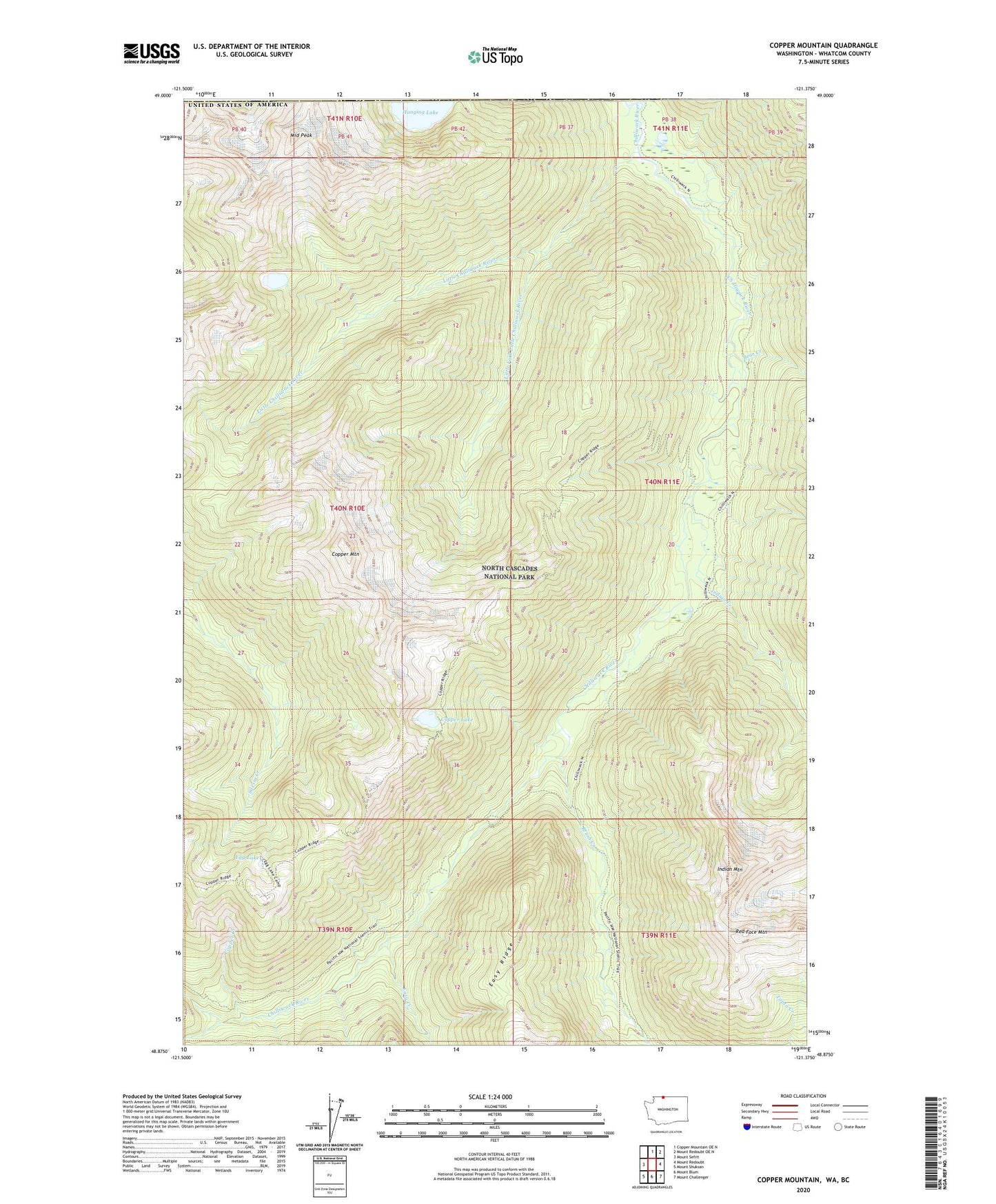
2020 topographic map quadrangle Copper Mountain in the state of Washington. Scale: 1:24000. Based on the newly updated USGS 7.5' US Topo map series, this map is in the following counties: Whatcom. The map contains contour data, water features, and other items you are used to seeing on USGS maps, but also has updated roads and other features. This is the next generation of topographic maps. Printed on high-quality waterproof paper with UV fade-resistant inks.
Quads adjacent to this one:
West: Mount Sefrit
North: Copper Mountain OE N
Northeast: Mount Redoubt OE N
East: Mount Redoubt
Southeast: Mount Challenger
South: Mount Blum
Southwest: Mount Shuksan
Contains the following named places: Bear Creek, Bear Creek Shelter, Brush Creek, Copper Creek, Copper Lake, Copper Mountain, Copper Mountain Lookout Tower, Easy Creek, Egg Lake, Greyball Shelter, Hanging Lake, Indian Creek, Indian Creek Shelter, Indian Mountain, Little Chilliwack River, Little Chilliwack Shelter, Little Fork Little Chilliwack River, Middle Peak, United States Cabin