
MyTopo
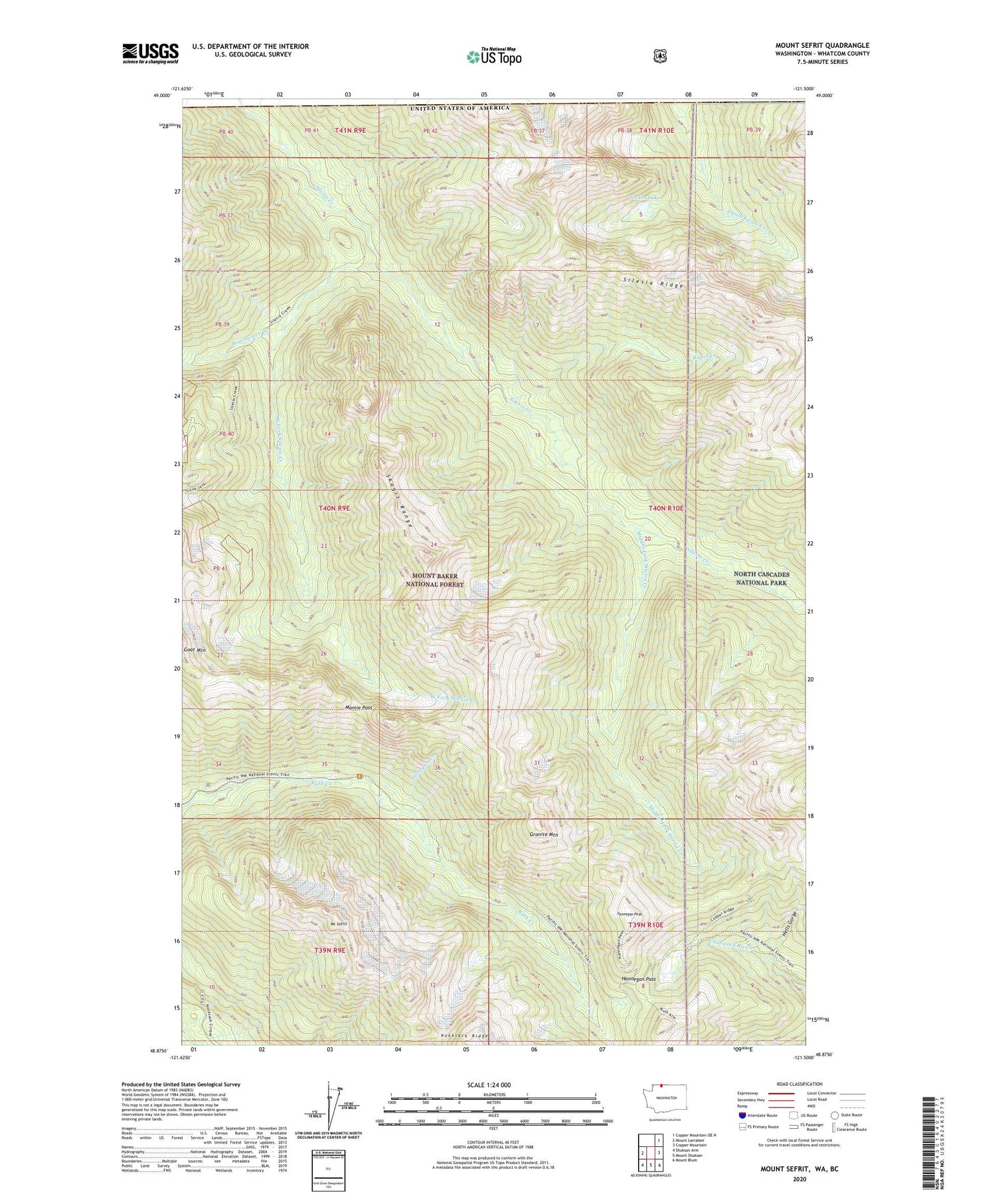
Mount Sefrit Washington US Topo Map
Couldn't load pickup availability
Also explore the Mount Sefrit Forest Service Topo of this same quad for updated USFS data
2023 topographic map quadrangle Mount Sefrit in the state of Washington. Scale: 1:24000. Based on the newly updated USGS 7.5' US Topo map series, this map is in the following counties: Whatcom. The map contains contour data, water features, and other items you are used to seeing on USGS maps, but also has updated roads and other features. This is the next generation of topographic maps. Printed on high-quality waterproof paper with UV fade-resistant inks.
Quads adjacent to this one:
West: Mount Larrabee
Northeast: Copper Mountain OE N
East: Copper Mountain
Southeast: Mount Blum
South: Mount Shuksan
Southwest: Shuksan Arm
This map covers the same area as the classic USGS quad with code o48121h5.
Contains the following named places: Boundary, Dead Mans Camp, Donegan Creek, Ensawkwatch Creek, Granite Mountain, Hannegan Campground, Hannegan Pass, Hannegan Peak, Hells Gorge, Lone Jack Mine, Mamie Pass, Middle Fork Silesia Creek, Mount Sefrit, Nooksack Ridge, Pocket Lake, Rapid Creek, Silesia Creek Shelter, Silesia Ridge, Skagit Range, West Fork Silesia Creek, Winchester Creek


