MyTopo
Mount Redoubt Washington US Topo Map
Couldn't load pickup availability
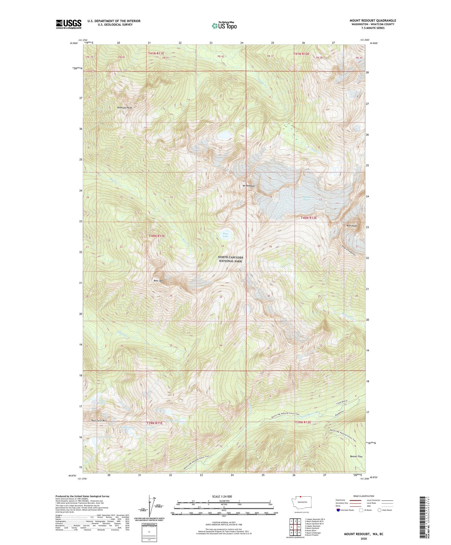
2023 topographic map quadrangle Mount Redoubt in the state of Washington. Scale: 1:24000. Based on the newly updated USGS 7.5' US Topo map series, this map is in the following counties: Whatcom. The map contains contour data, water features, and other items you are used to seeing on USGS maps, but also has updated roads and other features. This is the next generation of topographic maps. Printed on high-quality waterproof paper with UV fade-resistant inks.
Quads adjacent to this one:
West: Copper Mountain
Northwest: Copper Mountain OE N
North: Mount Redoubt OE N
Northeast: Mount Spickard OE N
East: Mount Spickard
Southeast: Mount Prophet
South: Mount Challenger
Southwest: Mount Blum
This map covers the same area as the classic USGS quad with code o48121h3.
Contains the following named places: Bear Lake, Bear Mountain, Beaver Pass, East Lakes, Lake Reveille, Middle Lakes, Mount Redoubt, Mox Peaks, Nodoubt Peak, Pass Creek, Red Face Mountain, Redoubt Glacier, Ridge of Gendarmes, Stillwell Shelter, Tapto Lakes, Tiny Lake, Whatcom Pass