MyTopo
Mount Shuksan Washington US Topo Map
Couldn't load pickup availability
Also explore the Mount Shuksan Forest Service Topo of this same quad for updated USFS data
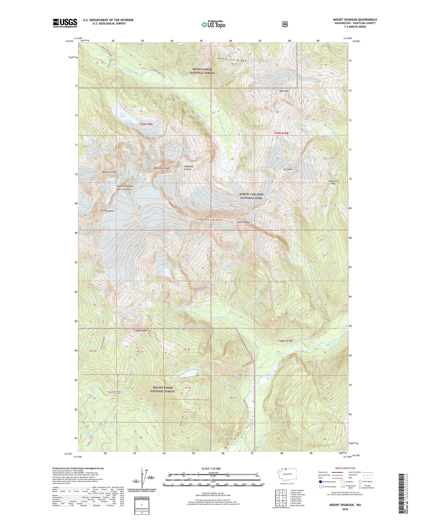
2023 topographic map quadrangle Mount Shuksan in the state of Washington. Scale: 1:24000. Based on the newly updated USGS 7.5' US Topo map series, this map is in the following counties: Whatcom. The map contains contour data, water features, and other items you are used to seeing on USGS maps, but also has updated roads and other features. This is the next generation of topographic maps. Printed on high-quality waterproof paper with UV fade-resistant inks.
Quads adjacent to this one:
West: Shuksan Arm
Northwest: Mount Larrabee
North: Mount Sefrit
Northeast: Copper Mountain
East: Mount Blum
Southeast: Damnation Peak
South: Bacon Peak
Southwest: Welker Peak
This map covers the same area as the classic USGS quad with code o48121g5.
Contains the following named places: Baker River, Blum Creek, Crystal Creek, Crystal Glacier, East Nooksack Glacier, Hanging Glacier, Icy Peak, Jagged Ridge, Lake Creek, Lower Curtis Glacier, Mount Shuksan, Nooksack Cirque, Nooksack Tower, Phantom Pass, Price Glacier, Price Lake, Ruth Mountain, Seahpo Peak, Shuksan Lake, Sulphide Creek, Sulphide Glacier, Sulphide Lake, Summit Pyramid, The Hourglass, Upper Curtis Glacier, West Nooksack Glacier, White Salmon Glacier, Winnies Slide