MyTopo
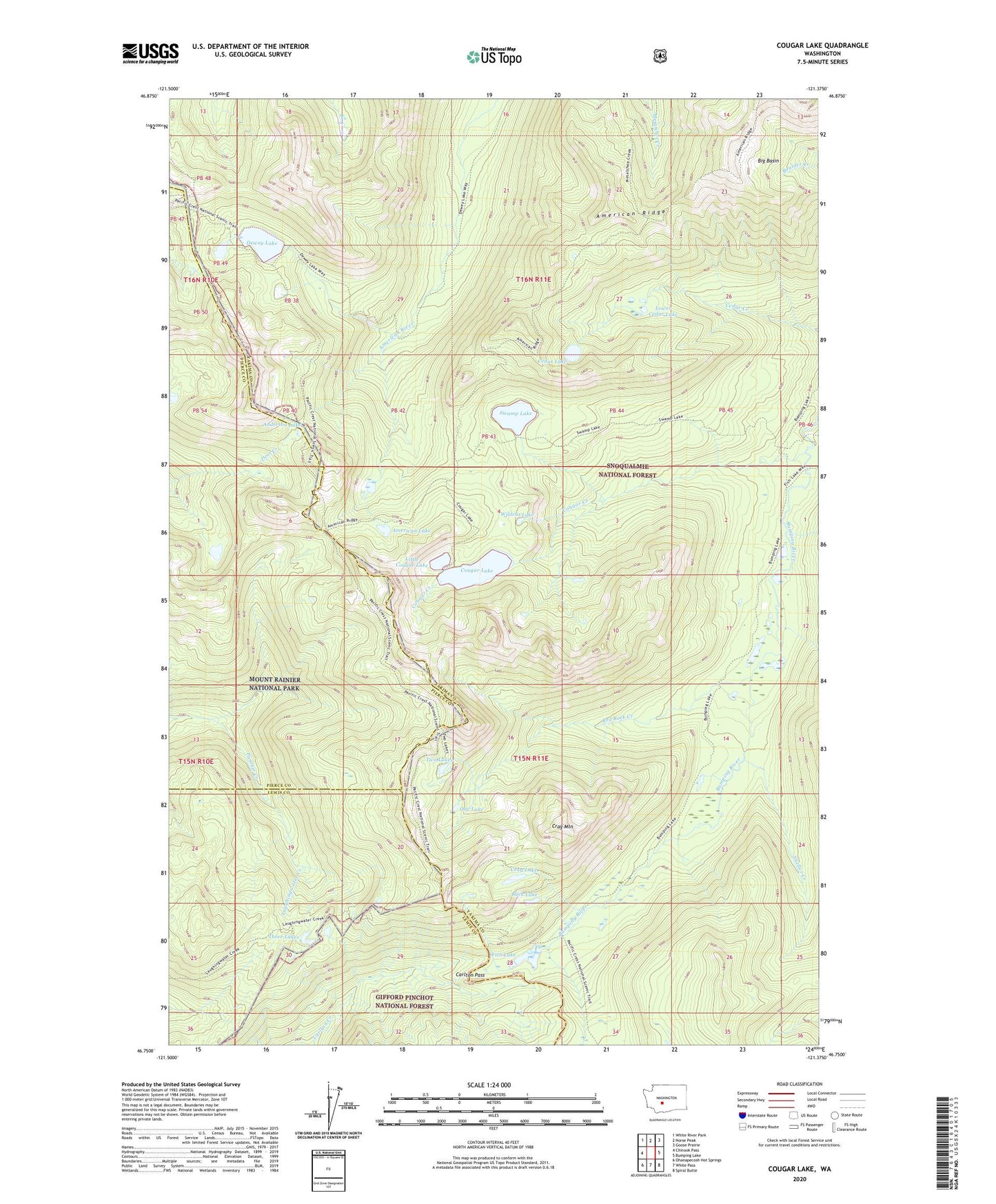
Cougar Lake Washington US Topo Map
Couldn't load pickup availability
Also explore the Cougar Lake Forest Service Topo of this same quad for updated USFS data
2023 topographic map quadrangle Cougar Lake in the state of Washington. Scale: 1:24000. Based on the newly updated USGS 7.5' US Topo map series, this map is in the following counties: Yakima, Pierce, Lewis. The map contains contour data, water features, and other items you are used to seeing on USGS maps, but also has updated roads and other features. This is the next generation of topographic maps. Printed on high-quality waterproof paper with UV fade-resistant inks.
Quads adjacent to this one:
West: Chinook Pass
Northwest: White River Park
North: Norse Peak
Northeast: Goose Prairie
East: Bumping Lake
Southeast: Spiral Butte
South: White Pass
Southwest: Ohanapecosh Hot Springs
This map covers the same area as the classic USGS quad with code o46121g4.
Contains the following named places: American Lake, Anderson Lake, Big Basin, Buck Lake, Bumping Lake Trail, Carlton Pass, Cedar Lake, Cougar Creek, Cougar Lake, Crag Lake, Crag Mountain, Dewey Lake, Dewey Lake Trail, Fish Lake, Little Cougar Lake, Lower Cedar Lake, One Lake, Red Rock Creek, Sheller Creek, Swamp Lake, Swamp Lake Trail, Three Lakes, Two Lakes, Wildcat Lake