MyTopo
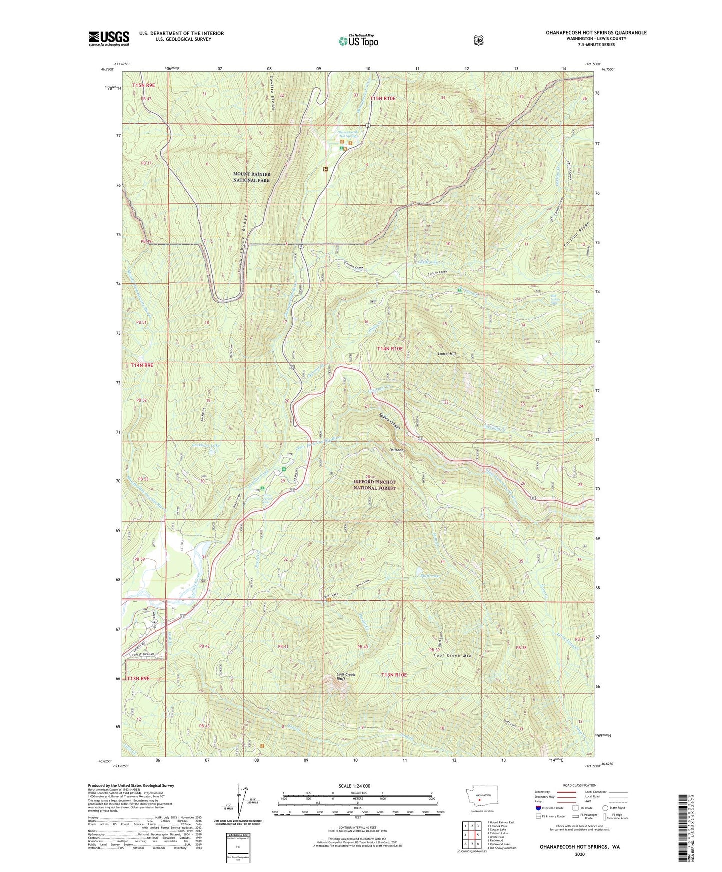
Ohanapecosh Hot Springs Washington US Topo Map
Couldn't load pickup availability
Also explore the Ohanapecosh Hot Springs Forest Service Topo of this same quad for updated USFS data
2023 topographic map quadrangle Ohanapecosh Hot Springs in the state of Washington. Scale: 1:24000. Based on the newly updated USGS 7.5' US Topo map series, this map is in the following counties: Lewis. The map contains contour data, water features, and other items you are used to seeing on USGS maps, but also has updated roads and other features. This is the next generation of topographic maps. Printed on high-quality waterproof paper with UV fade-resistant inks.
Quads adjacent to this one:
West: Tatoosh Lakes
Northwest: Mount Rainier East
North: Chinook Pass
Northeast: Cougar Lake
East: White Pass
Southeast: Old Snowy Mountain
South: Packwood Lake
Southwest: Packwood
This map covers the same area as the classic USGS quad with code o46121f5.
Contains the following named places: Ayance Canyon, Backbone Lake, Backbone Ridge, Backbone Ridge Trail, Bluff Lake, Bluff Lake Trail, Boundary Trail, Carlton Creek, Clear Fork Cowlitz River, Coal Creek, Coal Creek Bluff, Coal Creek Forest Camp, Cortright Creek, Dam Creek, Dinky Creek, Fish Ladder Falls, Grant Purcell Falls, Hatchery RV Campground, Huntington Berry Patch, La Wis Wis Campground, Laughingwater Creek, Laurel Hill, Laurel Hill Outlook, Lava Creek, Lava Creek Falls Viewpoint, Little Lava Creek, Lost Creek, Muddy Fork Cowlitz River, Ohanapecosh, Ohanapecosh Campground, Ohanapecosh Hot Springs, Ohanapecosh River, Ohanapecosh Visitor Center, Palisades, Palisades Campground, Palisades Viewpoint, Purcell Creek, River Bar Campground, Stevens Canyon, Summit Creek, Summit Creek Campground