MyTopo
Creston Washington US Topo Map
Couldn't load pickup availability
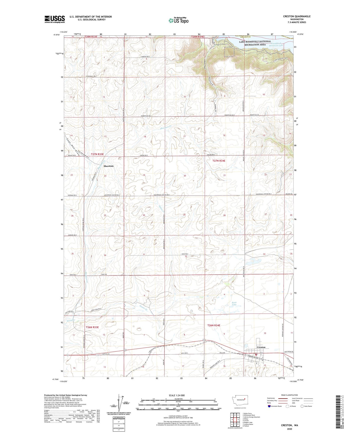
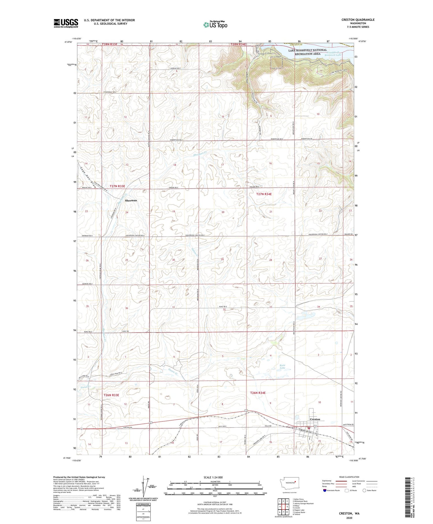
2020 topographic map quadrangle Creston in the state of Washington. Scale: 1:24000. Based on the newly updated USGS 7.5' US Topo map series, this map is in the following counties: Lincoln, Ferry. The map contains contour data, water features, and other items you are used to seeing on USGS maps, but also has updated roads and other features. This is the next generation of topographic maps. Printed on high-quality waterproof paper with UV fade-resistant inks.
Quads adjacent to this one:
West: Wilbur
Northwest: Keller Ferry
North: Whitestone Rock
Northeast: Johnny George Mountain
East: Lincoln
Southeast: Telford
South: Creston Butte
Southwest: Wagner Lake
Contains the following named places: Creston, Creston Ambulance, Creston Fire Department, Creston Junior - Senior High School, Creston Post Office, Hansen Dam, Jump Canyon, Kunz Lake, Moonshine Bay, Sage Hen Draw, Sherman, Sherman Creek, Town of Creston, ZIP Code: 99147