MyTopo
Johnny George Mountain Washington US Topo Map
Couldn't load pickup availability
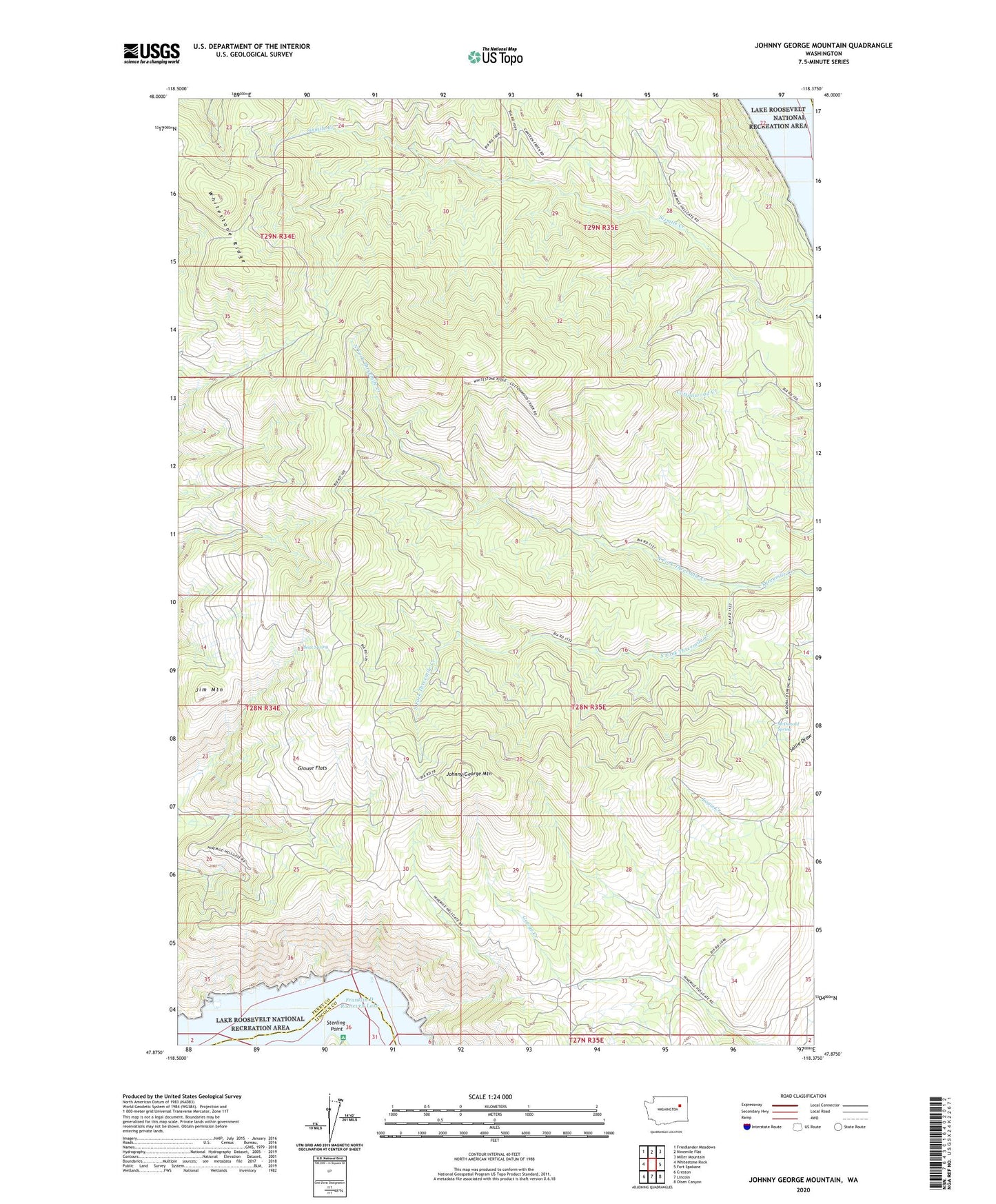
2023 topographic map quadrangle Johnny George Mountain in the state of Washington. Scale: 1:24000. Based on the newly updated USGS 7.5' US Topo map series, this map is in the following counties: Ferry, Lincoln, Stevens. The map contains contour data, water features, and other items you are used to seeing on USGS maps, but also has updated roads and other features. This is the next generation of topographic maps. Printed on high-quality waterproof paper with UV fade-resistant inks.
Quads adjacent to this one:
West: Whitestone Rock
Northwest: Friedlander Meadows
North: Ninemile Flat
Northeast: Miller Mountain
East: Fort Spokane
Southeast: Olsen Canyon
South: Lincoln
Southwest: Creston
This map covers the same area as the classic USGS quad with code o47118h4.
Contains the following named places: Bear Spring, Grouse Flats, Jim Mountain, Johnny George Mountain, McDonald Spring, North Fork Threemile Creek, South Fork Threemile Creek, Sterling Point