MyTopo
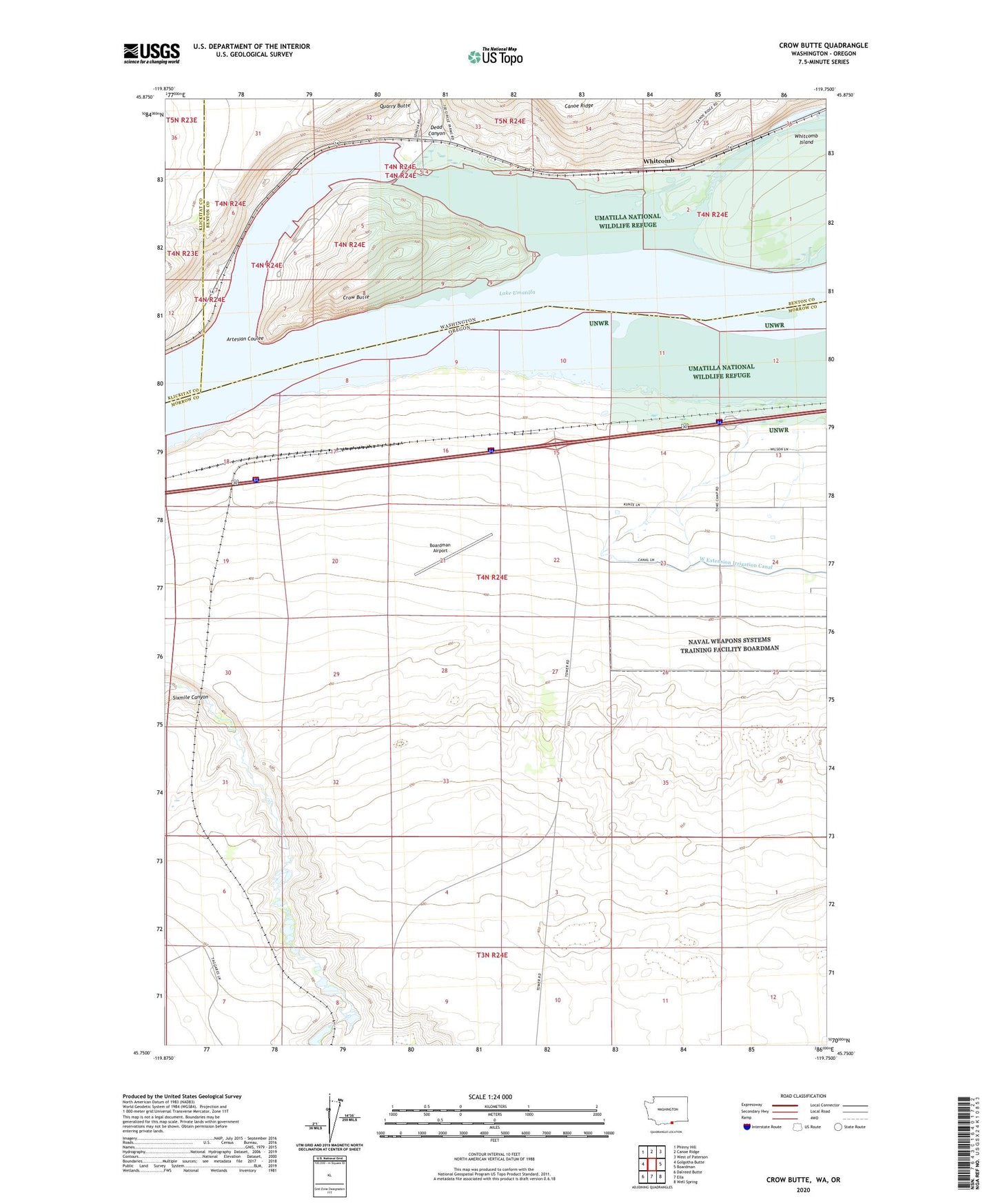
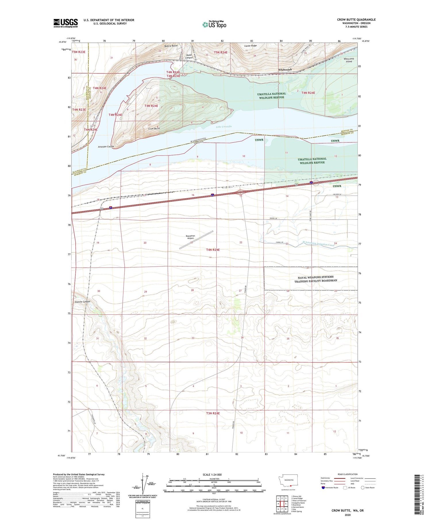
Crow Butte Washington US Topo Map
Couldn't load pickup availability
2020 topographic map quadrangle Crow Butte in the states of Oregon, Washington. Scale: 1:24000. Based on the newly updated USGS 7.5' US Topo map series, this map is in the following counties: Benton, Morrow, Klickitat. The map contains contour data, water features, and other items you are used to seeing on USGS maps, but also has updated roads and other features. This is the next generation of topographic maps. Printed on high-quality waterproof paper with UV fade-resistant inks.
Quads adjacent to this one:
West: Golgotha Butte
Northwest: Phinny Hill
North: Canoe Ridge
Northeast: West of Paterson
East: Boardman
Southeast: Well Spring
South: Ella
Southwest: Dalreed Butte
Contains the following named places: Artesian Coulee, Boardman Airport, Boardman Safety Rest Area, Canoe Encampment Rapids, Castle, Castle Rock Post Office, Crow Butte, Crow Butte State Park, Crow Butte Treaty Fishing Access Site, Dead Canyon, Quarry Butte, Seventh Day Adventist School, Umatilla National Wildlife Refuge, Whitcomb