MyTopo
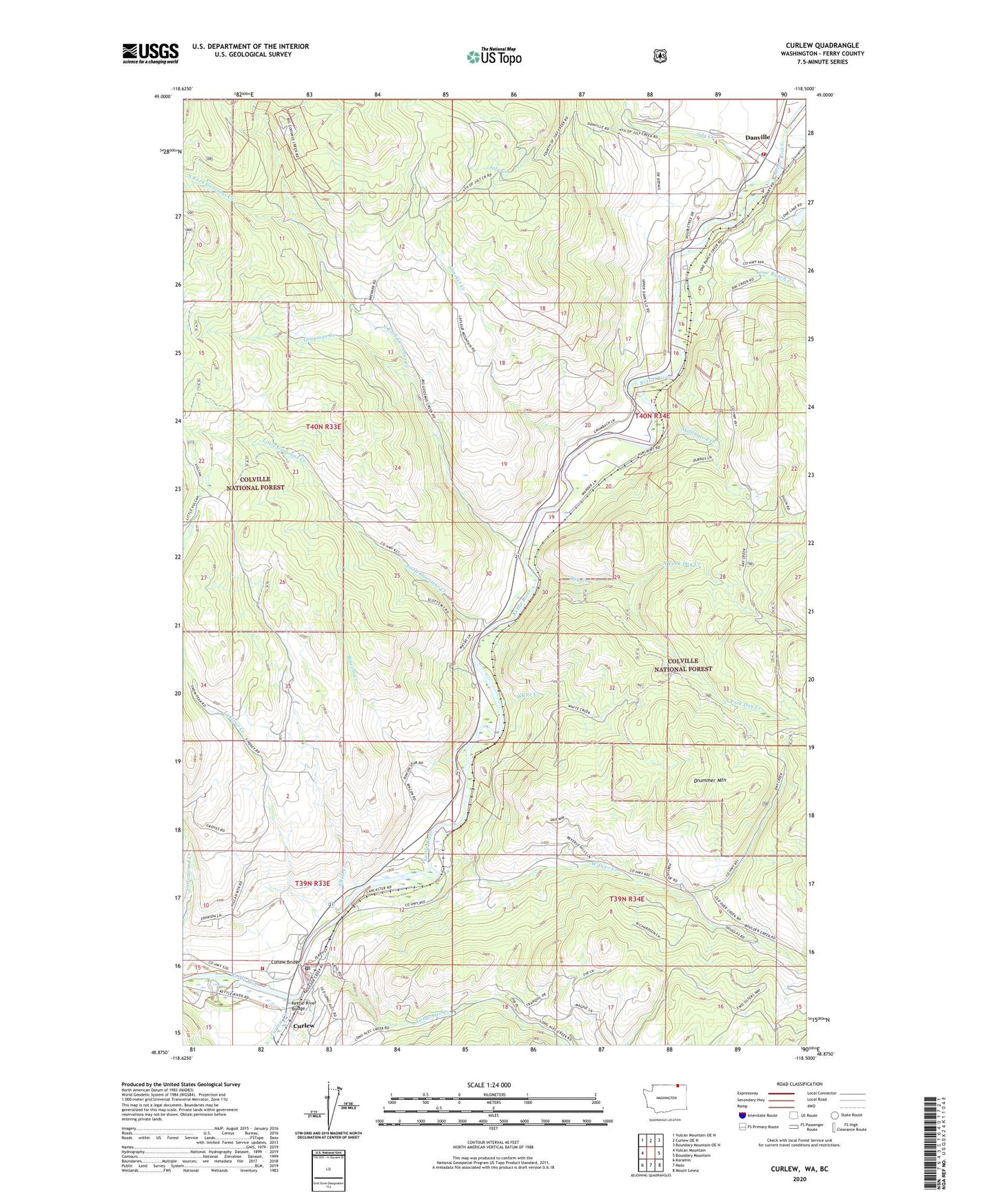
Curlew Washington US Topo Map
Couldn't load pickup availability
Also explore the Curlew Forest Service Topo of this same quad for updated USFS data
2023 topographic map quadrangle Curlew in the state of Washington. Scale: 1:24000. Based on the newly updated USGS 7.5' US Topo map series, this map is in the following counties: Ferry. The map contains contour data, water features, and other items you are used to seeing on USGS maps, but also has updated roads and other features. This is the next generation of topographic maps. Printed on high-quality waterproof paper with UV fade-resistant inks.
Quads adjacent to this one:
West: Vulcan Mountain
Northwest: Vulcan Mountain OE N
North: Curlew OE N
Northeast: Boundary Mountain OE N
East: Boundary Mountain
Southeast: Mount Leona
South: Malo
Southwest: Karamin
This map covers the same area as the classic USGS quad with code o48118h5.
Contains the following named places: Alkali Creek, Ansorge Hotel Museum, Curlew, Curlew Administration Site, Curlew Airport, Curlew Bridge, Curlew Census Designated Place, Curlew Creek, Curlew Division, Curlew Post Office, Danville, Danville Census Designated Place, Danville Post Office, Day Creek, Drummer Mountain, Ferry / Okanogan County Fire District 14 Danville, Ferry / Okanogan Fire District 14, Ferry / Okanogan Fire District 14 Curlew, Goosmus Creek, Hurlburt, July Creek, Kettle River Bridge, LaFleur Creek, Little Goosmus Creek, Lone Ranch Creek, Long Alec Creek, North Ferry County Ambulance, North Fork Day Creek, North Fork Goosmus Creek, Rincom Creek, Shasket Creek, Skiffington Creek, South Fork Day Creek, West Deer Creek, White Creek