MyTopo
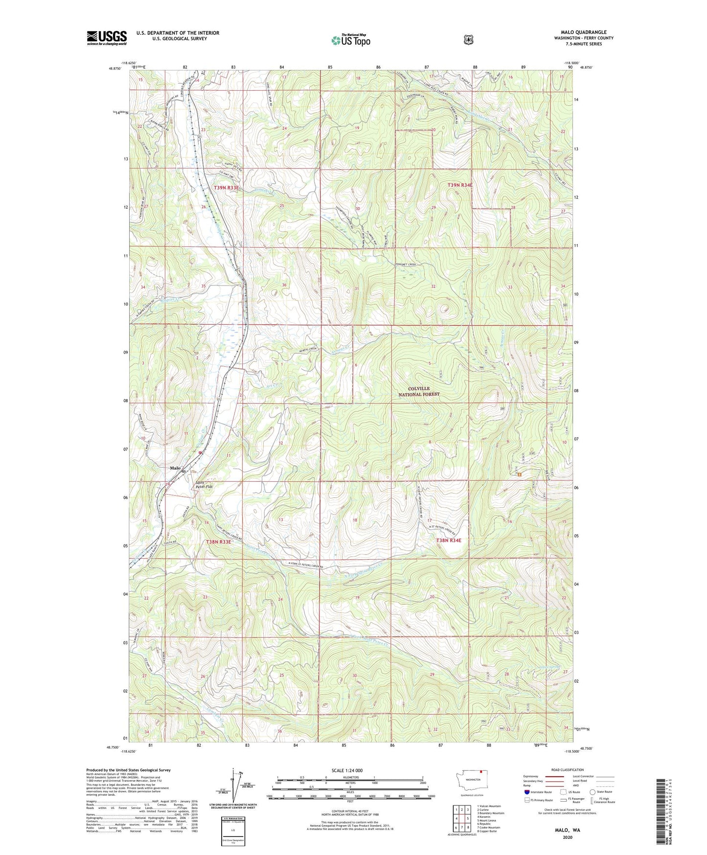
Malo Washington US Topo Map
Couldn't load pickup availability
Also explore the Malo Forest Service Topo of this same quad for updated USFS data
2023 topographic map quadrangle Malo in the state of Washington. Scale: 1:24000. Based on the newly updated USGS 7.5' US Topo map series, this map is in the following counties: Ferry. The map contains contour data, water features, and other items you are used to seeing on USGS maps, but also has updated roads and other features. This is the next generation of topographic maps. Printed on high-quality waterproof paper with UV fade-resistant inks.
Quads adjacent to this one:
West: Karamin
Northwest: Vulcan Mountain
North: Curlew
Northeast: Boundary Mountain
East: Mount Leona
Southeast: Copper Butte
South: Cooke Mountain
Southwest: Republic
This map covers the same area as the classic USGS quad with code o48118g5.
Contains the following named places: Aeneas Creek, Art Creek, Curlew Elementary and High School, Empire Creek, Ferry / Okanogan County Fire District 14 Malo, Green Spring, Malo, Malo Census Designated Place, Malo Post Office, Malo Trailer Court, North Fork Saint Peter Creek, Saint Peter Creek, Saint Peter Flat, South Fork Saint Peter Creek, Tonasket Creek, ZIP Code: 99150