MyTopo
Cypress Island Washington US Topo Map
Couldn't load pickup availability
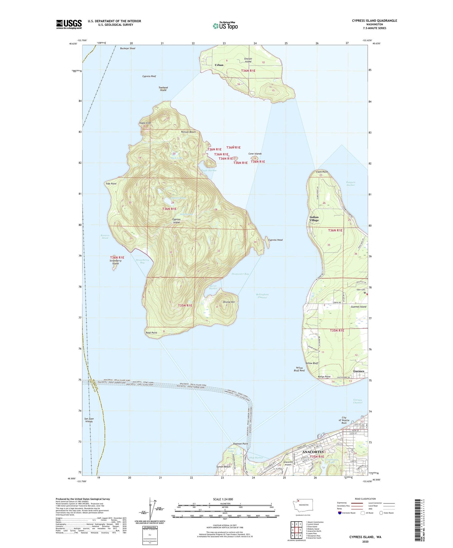
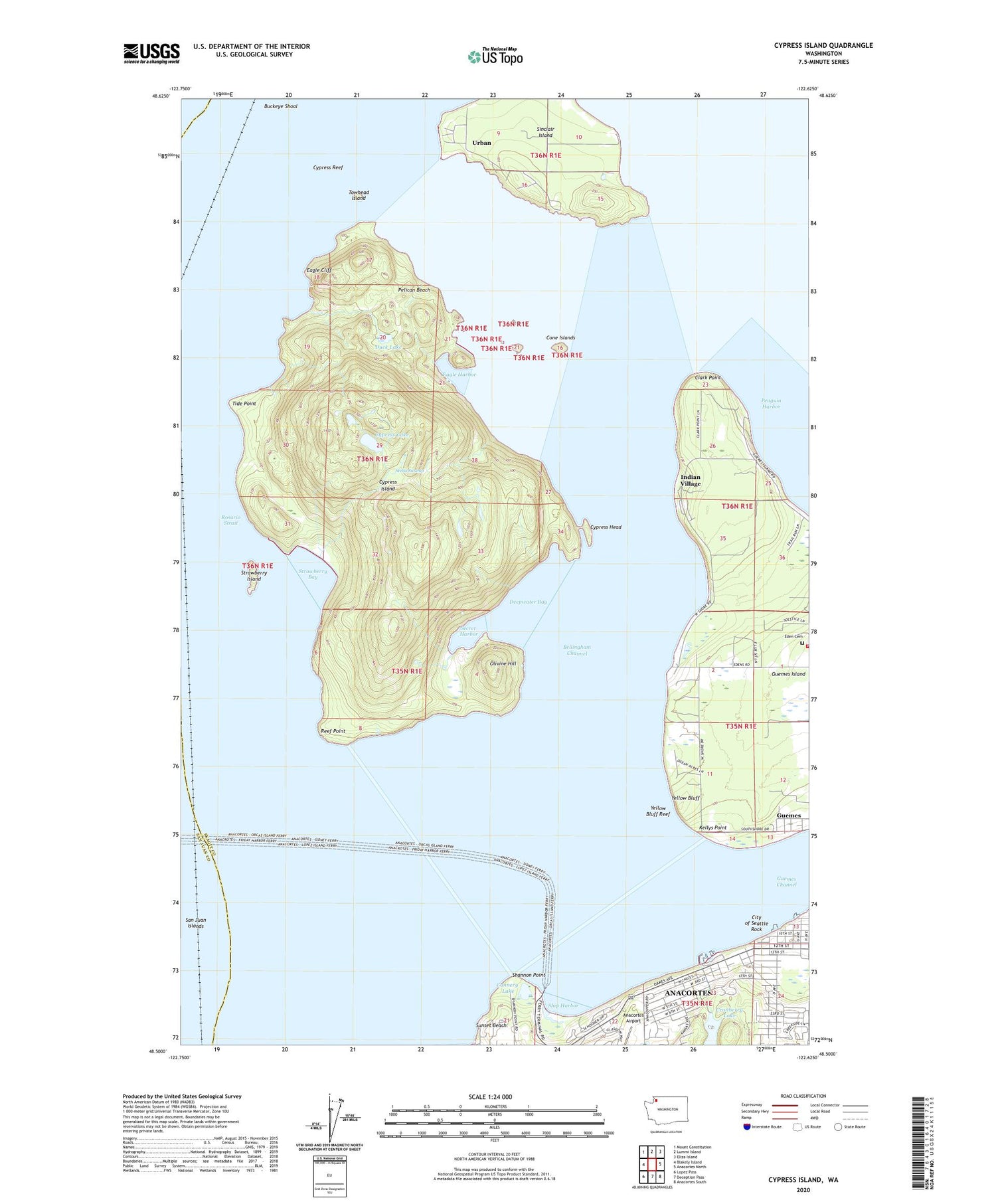
2020 topographic map quadrangle Cypress Island in the state of Washington. Scale: 1:24000. Based on the newly updated USGS 7.5' US Topo map series, this map is in the following counties: Skagit, San Juan. The map contains contour data, water features, and other items you are used to seeing on USGS maps, but also has updated roads and other features. This is the next generation of topographic maps. Printed on high-quality waterproof paper with UV fade-resistant inks.
Quads adjacent to this one:
West: Blakely Island
Northwest: Mount Constitution
North: Lummi Island
Northeast: Eliza Island
East: Anacortes North
Southeast: Anacortes South
South: Deception Pass
Southwest: Lopez Pass
Contains the following named places: Anacortes Division, Anacortes Ferry Landing, Bellingham Channel, Buckeye Shoal, Cannery Lake, City of Seattle Rock, Clark Point, Cone Islands, Cone Islands State Park, Cranberry Lake, Cranberry Lake Dam, Cranberry Lake Park, Cypress Head, Cypress Island, Cypress Island Airport, Cypress Island Light, Cypress Lake, Cypress Lake East Dam, Cypress Lake West Dam, Cypress Reef, Deepwater Bay, Devils Playground, Duck Lake, Eagle Cliff, Eagle Harbor, Eden Cemetery, Guemes Channel, Guemes Island, Indian Village, Kellys Point, Leona M Sundquist Marine Laboratory, North Beach, Olivine Hill, Pelican Beach, Reef Point, Rosario Strait, Secret Harbor, Shannon Point, Ship Harbor, Sinclair Island, Sinclair Island Light, Skagit County Fire District 17 Guemes Island Volunteer Fire Department, Stella Swamp, Strawberry Bay, Strawberry Island, Sunset Beach, Tide Point, Towhead Island, Urban, Yellow Bluff, Yellow Bluff Reef, ZIP Code: 98221