MyTopo
Lummi Island Washington US Topo Map
Couldn't load pickup availability
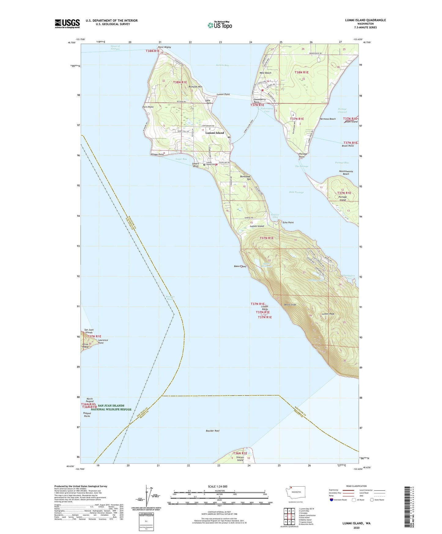
2023 topographic map quadrangle Lummi Island in the state of Washington. Scale: 1:24000. Based on the newly updated USGS 7.5' US Topo map series, this map is in the following counties: Whatcom, San Juan, Skagit. The map contains contour data, water features, and other items you are used to seeing on USGS maps, but also has updated roads and other features. This is the next generation of topographic maps. Printed on high-quality waterproof paper with UV fade-resistant inks.
Quads adjacent to this one:
West: Mount Constitution
Northwest: Lummi Bay OE W
North: Lummi Bay
Northeast: Ferndale
East: Eliza Island
Southeast: Anacortes North
South: Cypress Island
Southwest: Blakely Island
This map covers the same area as the classic USGS quad with code o48122f6.
Contains the following named places: Baker Reservoir, Bakers Reef, Beach, Beach Elementary School, Boulder Reef, Brant Island, Brant Point, Brown Dam, Bumstead Spit, Devils Slide, Echo Lodge, Echo Point, Fern Point, Fishermans Cove, Fisherman's Cove Marina, Gooseberry Point, Hale Passage, Hermosa Beach, Holiday Lake, Holiday Lake Dam, Lane Spit, Lawrence Point, Legoe Bay, Loganita Lodge, Lovers Bluff, Lummi Island, Lummi Island Cemetery, Lummi Island Congregational Church, Lummi Island Division, Lummi Island Est. Dam, Lummi Island Ferry Landing, Lummi Island Library, Lummi Island Post Office, Lummi Marine Park, Lummi Nation Tribal School, Lummi Peak, Lummi Point, Lummi Rocks, Lummi Youth Academy, Millers Field, Neontawanta Beach, North Peapod, Point Migley, Portage Bay, Portage Point, Richards Mountain, Smugglers Cove, Sunrise Cove, The Portage, The Willows, Village Point, West Beach, Whatcom County Ferry Landing, Whatcom County Fire District 11 Lummi Island Volunteer Fire Department, Whatcom County Fire District 8 Station 34, ZIP Code: 98262