MyTopo
Eliza Island Washington US Topo Map
Couldn't load pickup availability
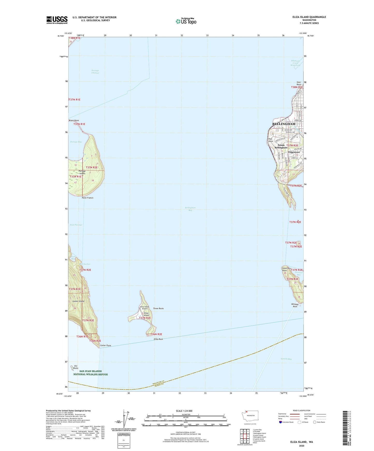
2023 topographic map quadrangle Eliza Island in the state of Washington. Scale: 1:24000. Based on the newly updated USGS 7.5' US Topo map series, this map is in the following counties: Whatcom, Skagit. The map contains contour data, water features, and other items you are used to seeing on USGS maps, but also has updated roads and other features. This is the next generation of topographic maps. Printed on high-quality waterproof paper with UV fade-resistant inks.
Quads adjacent to this one:
West: Lummi Island
Northwest: Lummi Bay
North: Ferndale
Northeast: Bellingham North
East: Bellingham South
Southeast: Bow
South: Anacortes North
Southwest: Cypress Island
This map covers the same area as the classic USGS quad with code o48122f5.
Contains the following named places: Bellingham Bay, Bellingham Public Library Fairhaven Branch, Bellingham Wastewater Treatment Plant, Breakwater Church, Carter Point, Chuckanut Bay, Chuckanut Island, Chuckanut Rock, Edgemoor, Eliza Island, Eliza Island Airport, Eliza Rock, Fairhaven, Fairhaven Marine Industrial Park, Fairhaven Middle School, Fairhaven Park and Ride, Governors Point, Inati Bay, Padden Creek, Padden Creek Marine, Pleasant Bay, Point Francis, Port of Bellingham Marine Park, Portage Channel, Portage Island, Post Point, Reil Harbor, Sacred Heart Catholic Church Parish Hall, Saint James Presbyterian Church, Starr Rock, Three Rocks, Viti Rocks, Whiskey Rock