MyTopo
Lopez Pass Washington US Topo Map
Couldn't load pickup availability
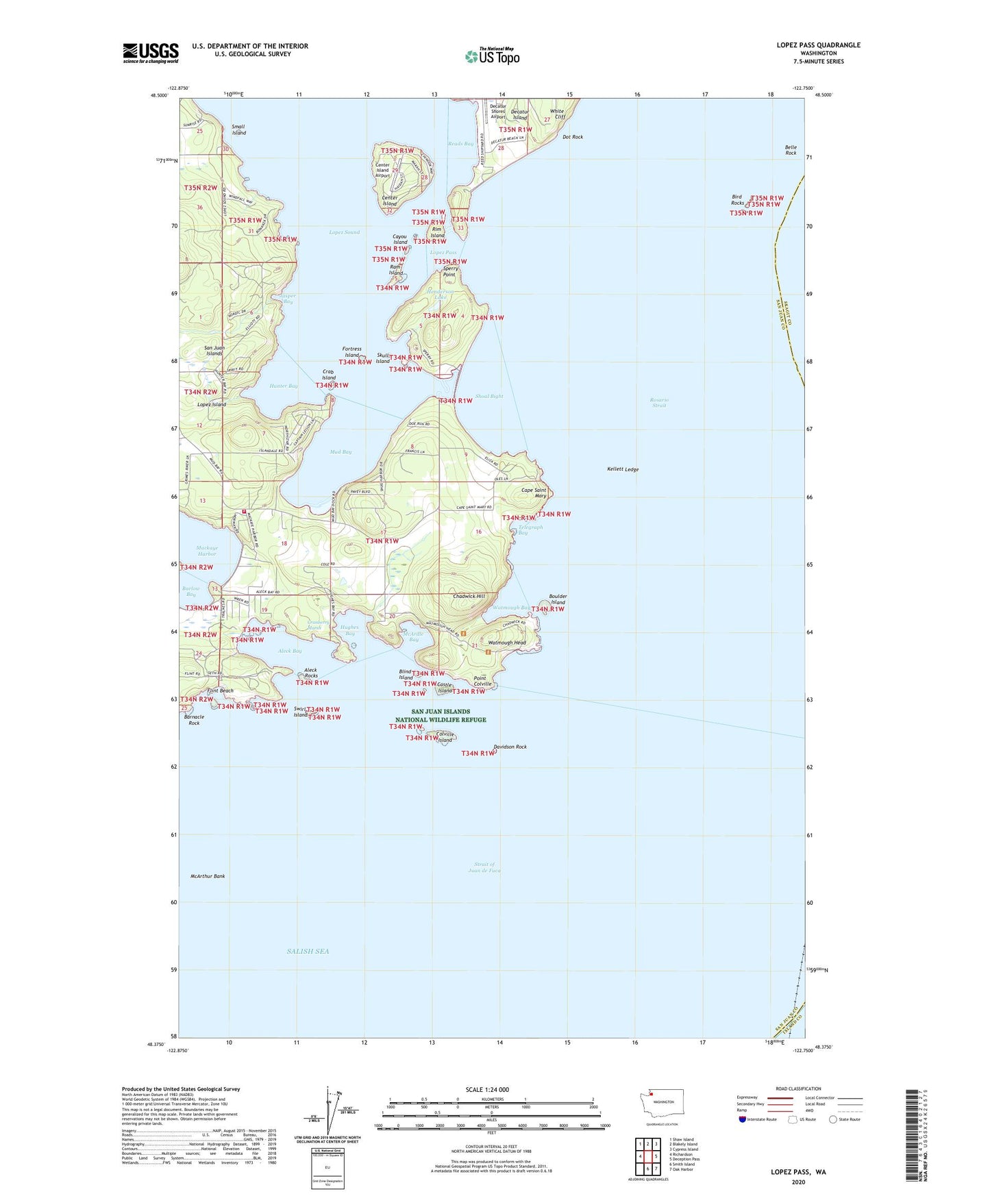
2023 topographic map quadrangle Lopez Pass in the state of Washington. Scale: 1:24000. Based on the newly updated USGS 7.5' US Topo map series, this map is in the following counties: San Juan, Skagit, Island. The map contains contour data, water features, and other items you are used to seeing on USGS maps, but also has updated roads and other features. This is the next generation of topographic maps. Printed on high-quality waterproof paper with UV fade-resistant inks.
Quads adjacent to this one:
West: Richardson
Northwest: Shaw Island
North: Blakely Island
Northeast: Cypress Island
East: Deception Pass
Southeast: Oak Harbor
South: Smith Island
This map covers the same area as the classic USGS quad with code o48122d7.
Contains the following named places: Aleck Bay, Aleck Rocks, Barlow Bay, Barnacle Rock, Belle Rock, Belle Rock Light, Bird Rocks, Blind Island, Boulder Island, Cape Saint Mary, Castle Island, Cayou Island, Center Island, Center Island Airport, Chadwick Hill, Colville Island, Crab Island, Cranberry Marsh, Davidson Rock, Davidson Rock Light, Decatur Island Schools, Decatur Shores Airport, Dot Rock, Dot Rock State Park, Flint Beach, Fortress Island, Henderson Lake, Hughes Bay, Hunter Bay, Islandale, Jasper Bay, Kellett Ledge, Lopez Division, Lopez Pass, Mackaye Harbor Public Dock, McArdle Bay, Mud Bay, Point Colville, Ram Island, Reads Bay, Rim Island, San Juan County Fire District 4 Station 42, San Juan Islands National Monument, Shoal Bight, Skull Island, Small Island, Sperry Point, Swirl Island, Telegraph Bay, Watmough Bay, Watmough Head, White Cliff