MyTopo
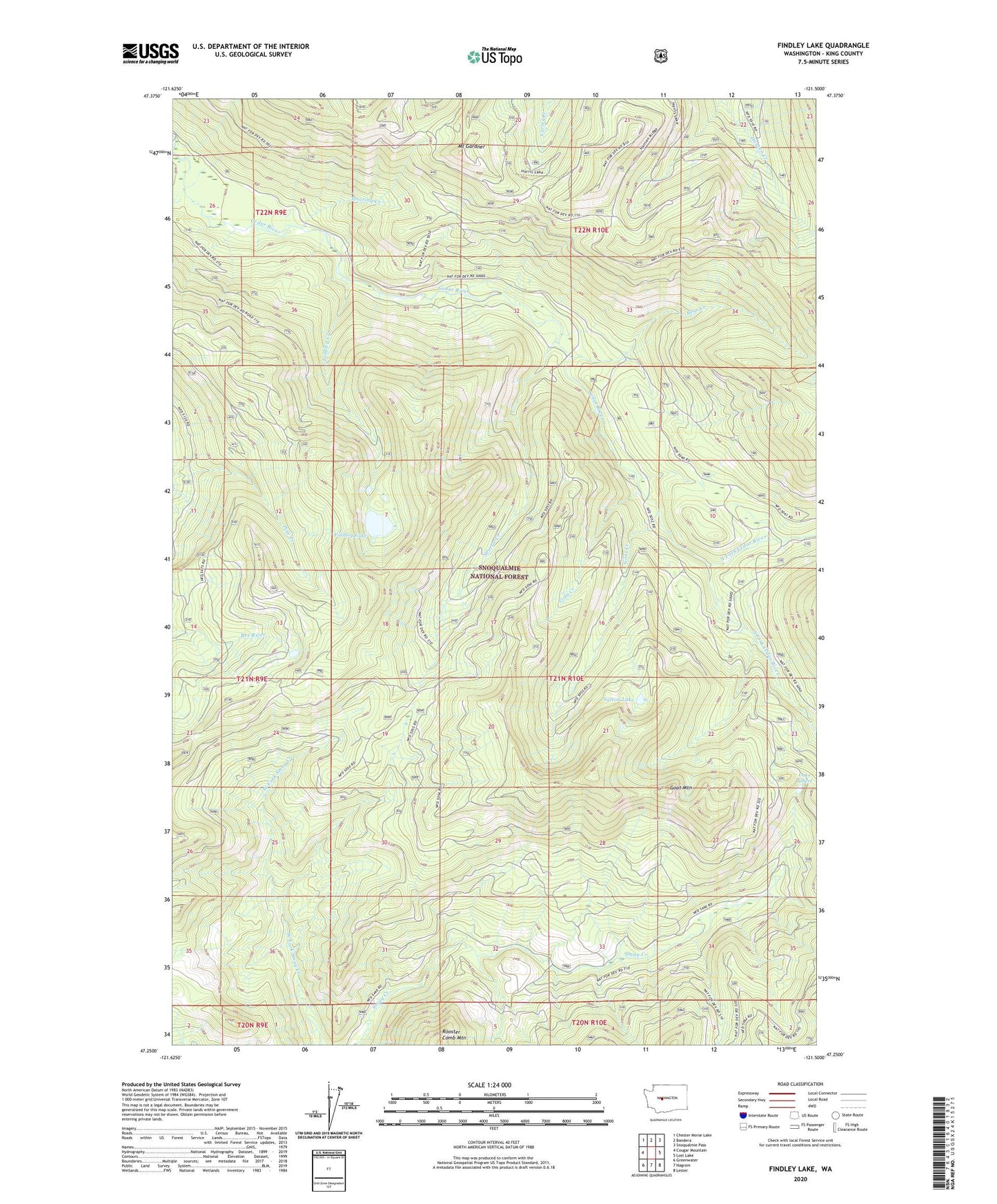
Findley Lake Washington US Topo Map
Couldn't load pickup availability
Also explore the Findley Lake Forest Service Topo of this same quad for updated USFS data
2023 topographic map quadrangle Findley Lake in the state of Washington. Scale: 1:24000. Based on the newly updated USGS 7.5' US Topo map series, this map is in the following counties: King. The map contains contour data, water features, and other items you are used to seeing on USGS maps, but also has updated roads and other features. This is the next generation of topographic maps. Printed on high-quality waterproof paper with UV fade-resistant inks.
Quads adjacent to this one:
West: Cougar Mountain
Northwest: Chester Morse Lake
North: Bandera
Northeast: Snoqualmie Pass
East: Lost Lake
Southeast: Lester
South: Nagrom
Southwest: Greenwater
This map covers the same area as the classic USGS quad with code o47121c5.
Contains the following named places: Bear Creek, Bear Creek Cabin, Cedar River Watershed, City Cabin, Findley Creek, Findley Lake, Gardner Mountain Trail, Goat Creek, Goat Mountain, Hansen Creek Trail, Lake Albert, Mount Gardner, North Fork Cedar River, Roaring Creek, Seattle Creek, South Fork Cedar River, Sutton Lake, Viola Creek