MyTopo
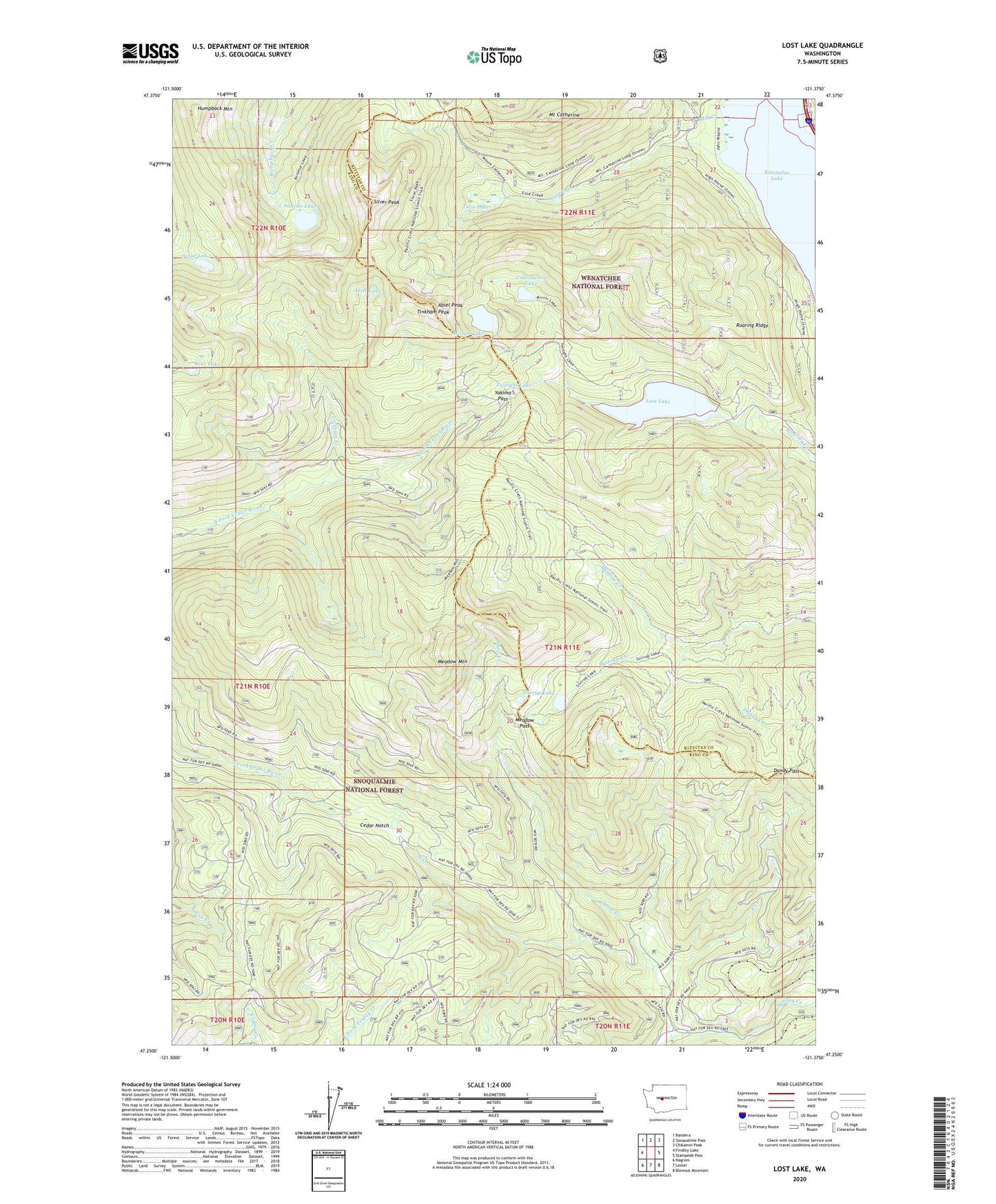
Lost Lake Washington US Topo Map
Couldn't load pickup availability
Also explore the Lost Lake Forest Service Topo of this same quad for updated USFS data
2023 topographic map quadrangle Lost Lake in the state of Washington. Scale: 1:24000. Based on the newly updated USGS 7.5' US Topo map series, this map is in the following counties: King, Kittitas. The map contains contour data, water features, and other items you are used to seeing on USGS maps, but also has updated roads and other features. This is the next generation of topographic maps. Printed on high-quality waterproof paper with UV fade-resistant inks.
Quads adjacent to this one:
West: Findley Lake
Northwest: Bandera
North: Snoqualmie Pass
Northeast: Chikamin Peak
East: Stampede Pass
Southeast: Blowout Mountain
South: Lester
Southwest: Nagrom
This map covers the same area as the classic USGS quad with code o47121c4.
Contains the following named places: Abiel Lake, Abiel Peak, Annette Lake, Annette Lake Trail, Bear Lake, Cascade Crest Trail, Cedar Notch, Cold Creek, Cottonwood Lake, Dandy Creek, Dandy Pass, East Creek, Fort Tilton Historical Marker, Humpback Mountain, Lost Lake, Meadow Mountain, Meadow Pass, Mill Creek, Mirror Lake, Mount Catherine, Roaring Ridge, Roaring Ridge Lookout, Rocky Run, Scout Lake, Silver Peak, Snow Creek, Stirrup Creek, Stirrup Lake, Tinkham Creek, Tinkham Peak, Twilight Lake, Twin Lakes, West Creek, Yakima Pass