MyTopo
Finney Peak Washington US Topo Map
Couldn't load pickup availability
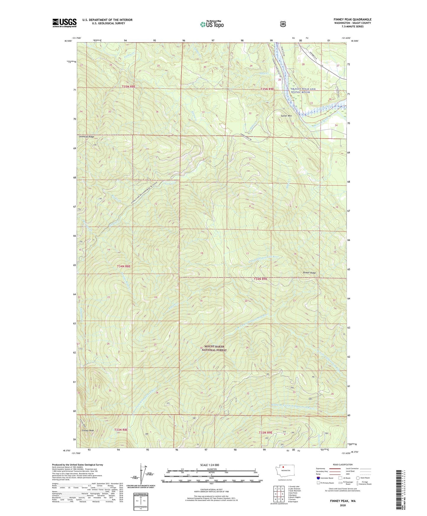
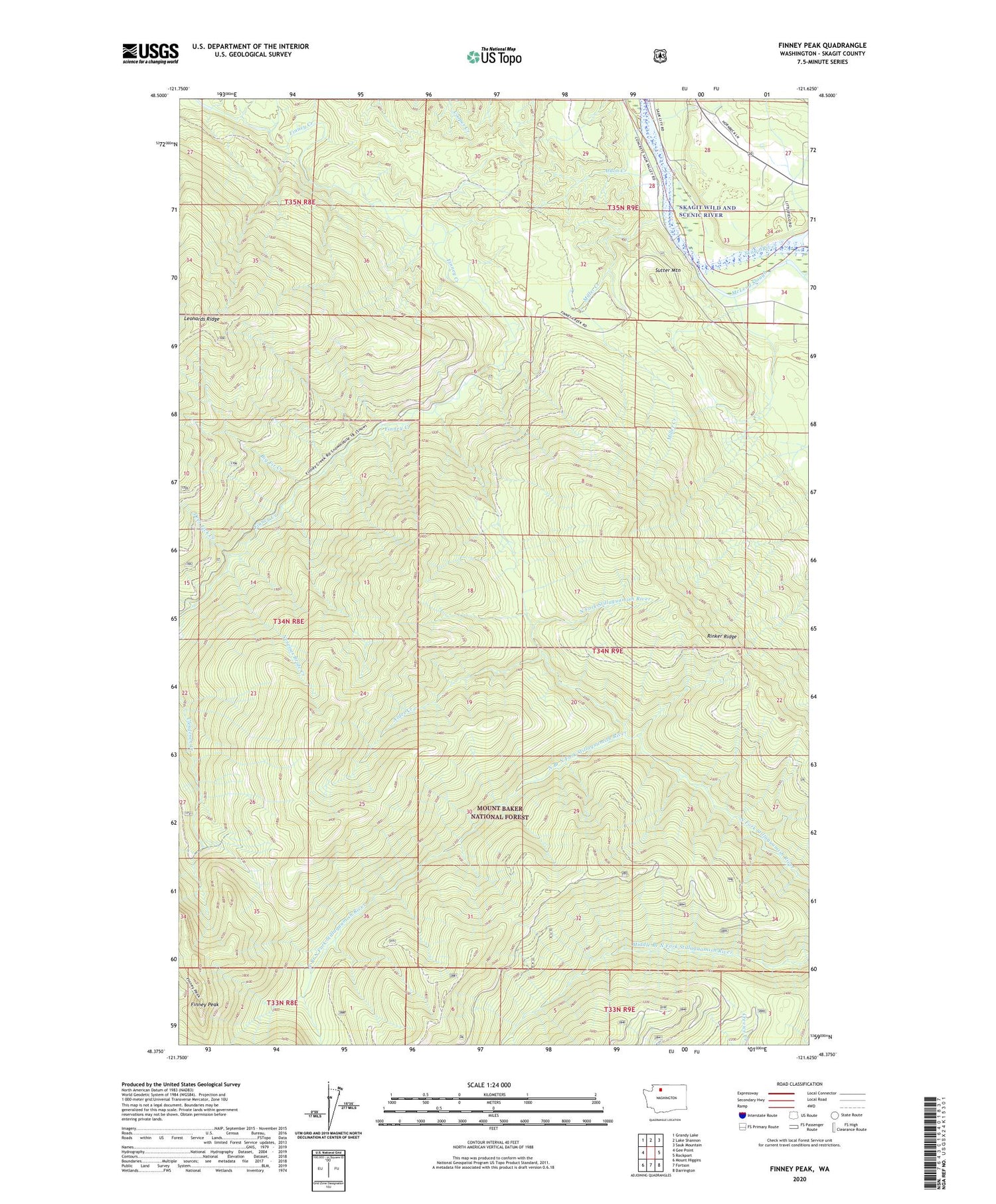
2020 topographic map quadrangle Finney Peak in the state of Washington. Scale: 1:24000. Based on the newly updated USGS 7.5' US Topo map series, this map is in the following counties: Skagit. The map contains contour data, water features, and other items you are used to seeing on USGS maps, but also has updated roads and other features. This is the next generation of topographic maps. Printed on high-quality waterproof paper with UV fade-resistant inks.
Quads adjacent to this one:
West: Gee Point
Northwest: Grandy Lake
North: Lake Shannon
Northeast: Sauk Mountain
East: Rockport
Southeast: Darrington
South: Fortson
Southwest: Mount Higgins
Contains the following named places: Alder Creek, Aldon Creek, Big Fir Creek, Deer Lick Creek, Finney Creek Shelter, Finney Peak, Finney Peak Lookout, Gee Creek, McLeod Slough, Miller Creek, Nervous Bride Creek, North Branch North Fork Stillaguamish River, Rinker Ridge, Rockport Quarry, Sauk, Sauk Guard Station, Sauk Station, Sutter Mountain