MyTopo
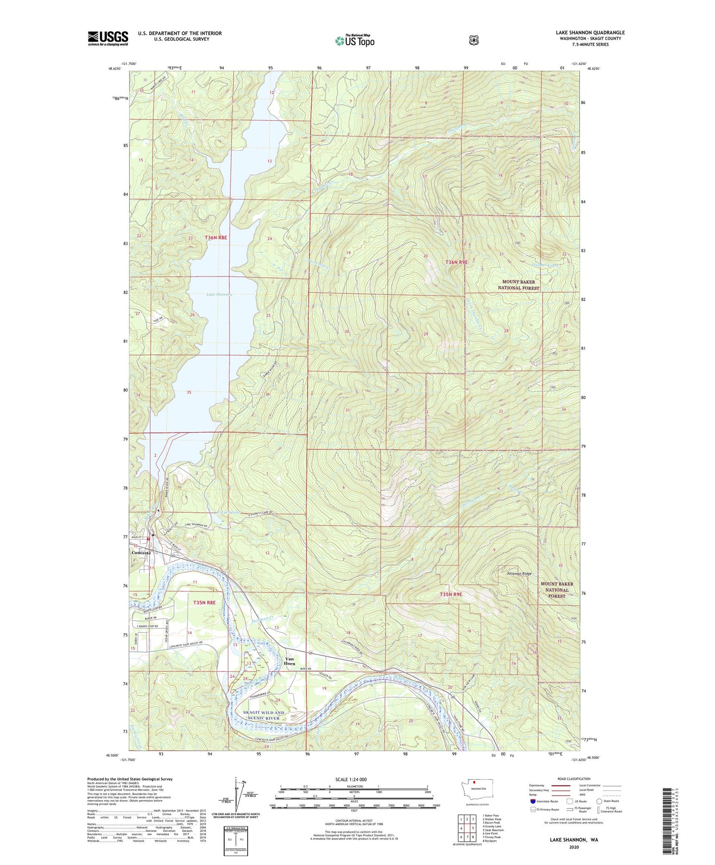
Lake Shannon Washington US Topo Map
Couldn't load pickup availability
Also explore the Lake Shannon Forest Service Topo of this same quad for updated USFS data
2023 topographic map quadrangle Lake Shannon in the state of Washington. Scale: 1:24000. Based on the newly updated USGS 7.5' US Topo map series, this map is in the following counties: Skagit. The map contains contour data, water features, and other items you are used to seeing on USGS maps, but also has updated roads and other features. This is the next generation of topographic maps. Printed on high-quality waterproof paper with UV fade-resistant inks.
Quads adjacent to this one:
West: Grandy Lake
Northwest: Baker Pass
North: Welker Peak
Northeast: Bacon Peak
East: Sauk Mountain
Southeast: Rockport
South: Finney Peak
Southwest: Gee Point
This map covers the same area as the classic USGS quad with code o48121e6.
Contains the following named places: Aero - Skagit Emergency Services, Baker Dam, Bear Creek, Bear Creek Dam, Bear Creek Powerhouse, Concrete, Concrete Fire Department, Concrete Sewage Treatment Plant, Cooper Creek, Everett Lake, Faber Ferry, Jackman Creek, Jackman Ridge, Kingdom Hall of Jehovahs Witnesses, Lake Shannon, Mountview, Nestos, South Fork Thunder Creek, Survey Creek, Threemile Creek, Thunder Creek, Thunder Lakes, Upper Skagit Garden Club Park, Upper Skagit Library, Van Horn, Weber Creek