MyTopo
Grandy Lake Washington US Topo Map
Couldn't load pickup availability
Also explore the Grandy Lake Forest Service Topo of this same quad for updated USFS data
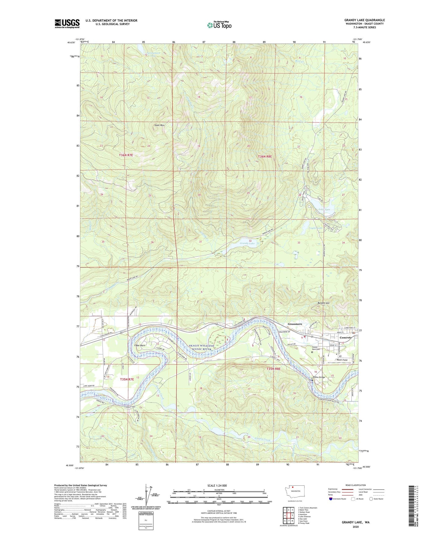
2023 topographic map quadrangle Grandy Lake in the state of Washington. Scale: 1:24000. Based on the newly updated USGS 7.5' US Topo map series, this map is in the following counties: Skagit. The map contains contour data, water features, and other items you are used to seeing on USGS maps, but also has updated roads and other features. This is the next generation of topographic maps. Printed on high-quality waterproof paper with UV fade-resistant inks.
Quads adjacent to this one:
West: Hamilton
Northwest: Twin Sisters Mountain
North: Baker Pass
Northeast: Welker Peak
East: Lake Shannon
Southeast: Finney Peak
South: Gee Point
Southwest: Day Lake
This map covers the same area as the classic USGS quad with code o48121e7.
Contains the following named places: Baker River Ranger Station, Burpee Hill, Cape Horn, Community Bible Church, Concrete Assembly of God Church, Concrete Elementary School, Concrete High School, Concrete Middle School, Concrete Post Office, Concrete School District 11 Office, Concrete Town Hall, Dalles Bridge, Eagle Hill Quarry, Finney Creek, Forest Park Cemetery, Goat Mountain, Grandy Lake, Grassmere, Hatchery Creek, Lake Tyee, Mears Field, Mount Baker Presbyterian Church, Pressentin Creek, Quartz Creek, Skagit County Fire District 10 Grassmere Fire Department, Skagit County Sheriff's Office Concrete / East Detachment, Skagit Lake Dam, Skagit River School House, Springsteen Lake, Timberline Mobile Home Park, Town of Concrete, Vogler Lake