MyTopo
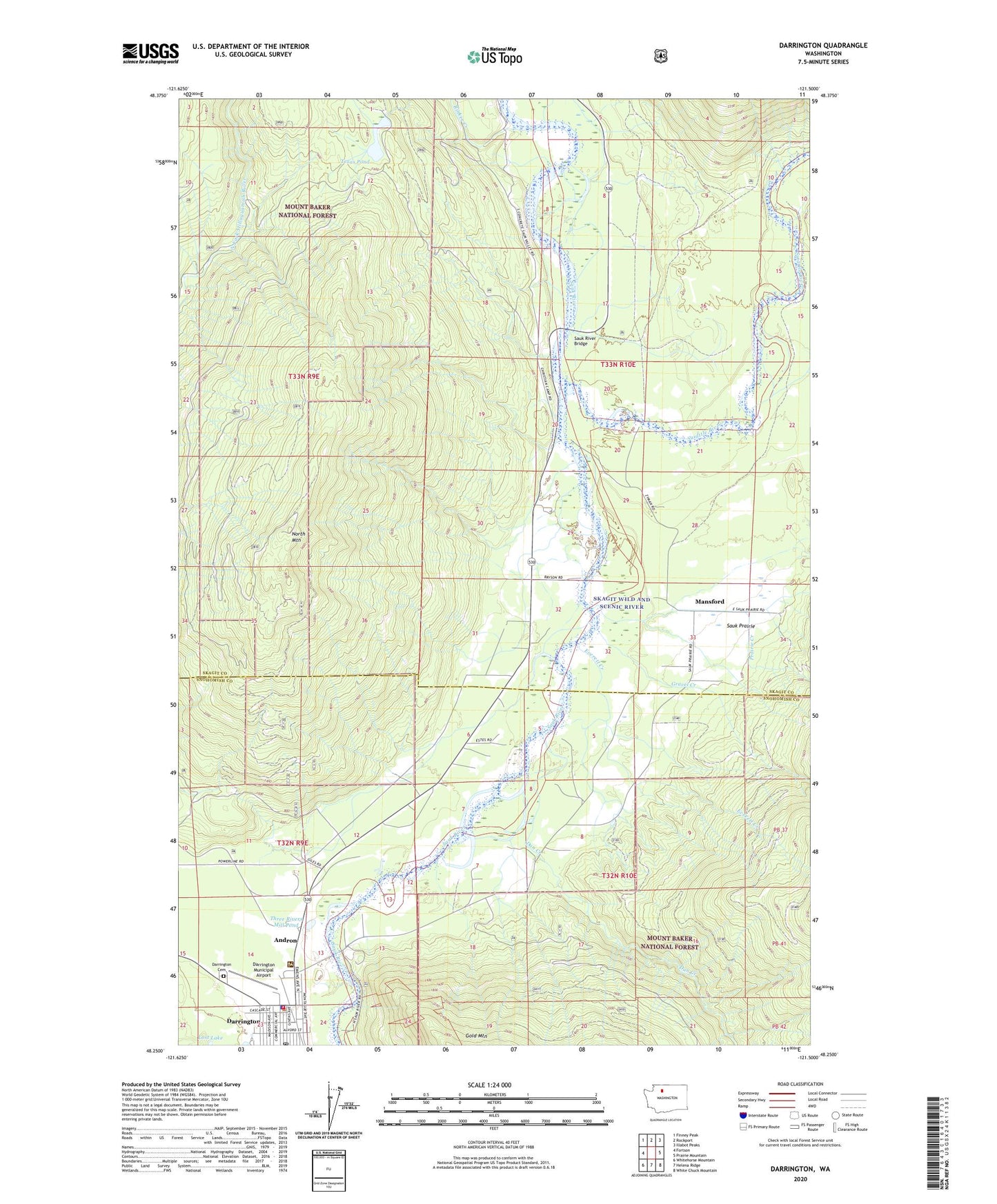
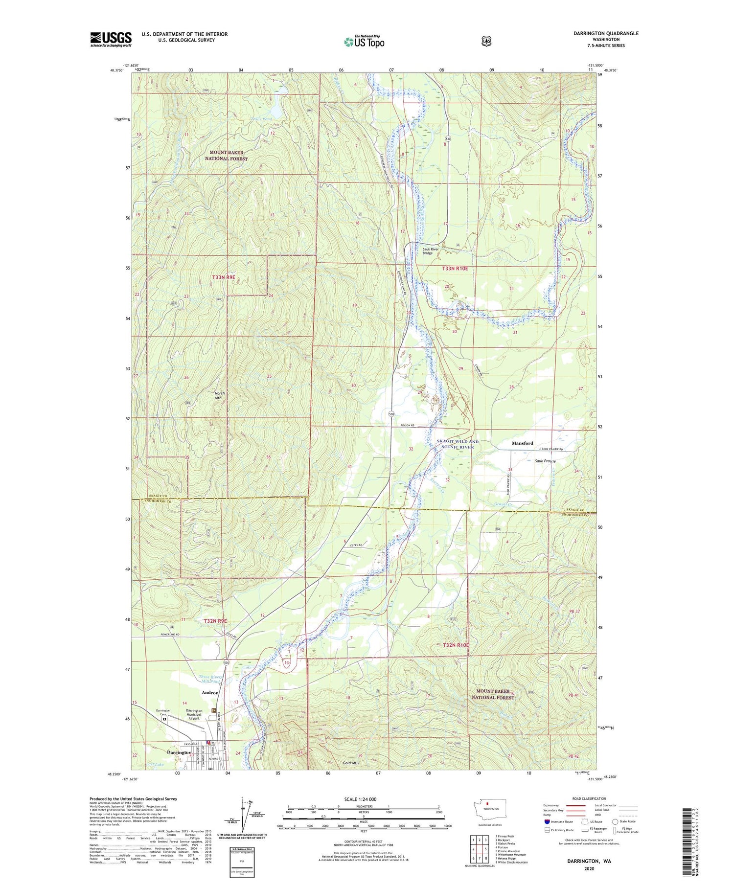
Darrington Washington US Topo Map
Couldn't load pickup availability
Also explore the Darrington Forest Service Topo of this same quad for updated USFS data
2023 topographic map quadrangle Darrington in the state of Washington. Scale: 1:24000. Based on the newly updated USGS 7.5' US Topo map series, this map is in the following counties: Skagit, Snohomish. The map contains contour data, water features, and other items you are used to seeing on USGS maps, but also has updated roads and other features. This is the next generation of topographic maps. Printed on high-quality waterproof paper with UV fade-resistant inks.
Quads adjacent to this one:
West: Fortson
Northwest: Finney Peak
North: Rockport
Northeast: Illabot Peaks
East: Prairie Mountain
Southeast: White Chuck Mountain
South: Helena Ridge
Southwest: Whitehorse Mountain
This map covers the same area as the classic USGS quad with code o48121c5.
Contains the following named places: Andron, Cascade Kamloops Trout Farm Mobile Home Park, Cascade Kamloops Trout Farm Recreational Vehicle Park, Dan Creek, Darrington, Darrington Cemetery, Darrington Library, Darrington Mobile Home Park 1, Darrington Municipal Airport, Darrington Post Office, Darrington United Methodist Church, DOT City Park, Everett Creek, Glad Tidings Assembly of God Church, Gravel Creek, Hiline Heliport, Indian Cemetery, Lost Lake, Mansford, Mount Baker National Forest Ranger Station, Mountain View Baptist Church, Nels Bruseth Memorial Garden, Nels Bruseth Memorial Park, North Mountain, Prairie Creek, Rinker Creek, Sauk - Suiattle Tribe Daycare Center, Sauk Prairie, Sauk River Bridge, Sauk-Suiattle Reservation, Snohomish County Fire District 24 Station 39 Darrington Fire Department, Snohomish County Sheriff's Office Darrington Substation, Sturgeons Ranch Landing Area, Suiattle River, Texas Pond, Texas Pond Dam, Three Rivers Mill Pond, Three Rivers Mill Pond Dam, Town of Darrington