MyTopo
Fortson Washington US Topo Map
Couldn't load pickup availability
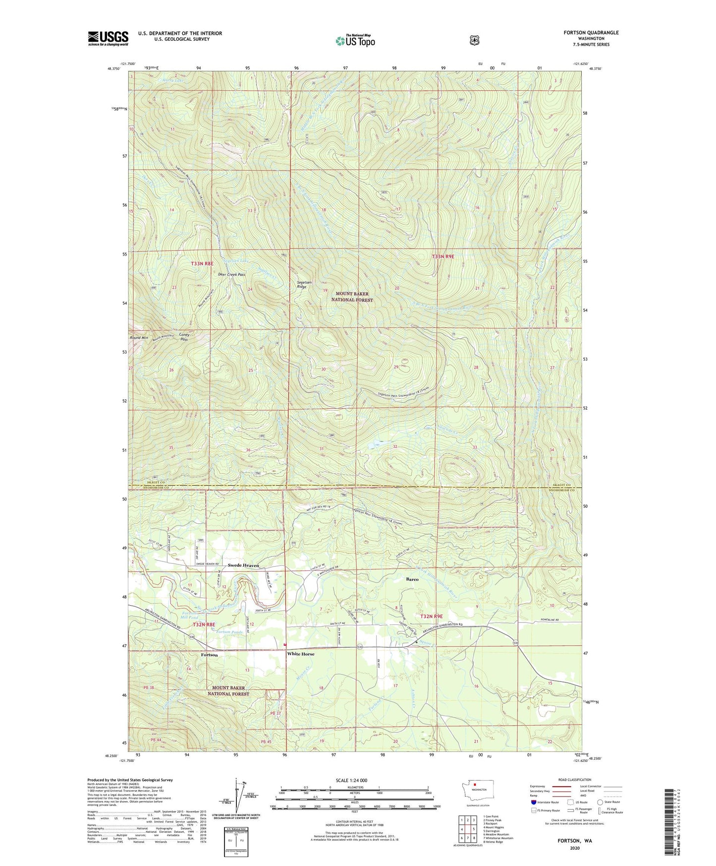
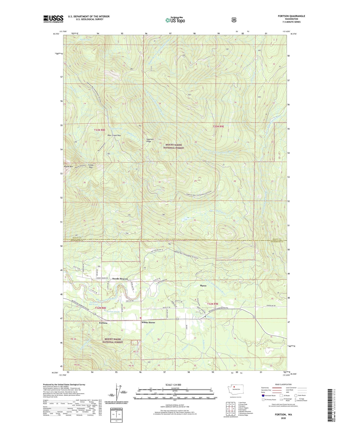
2020 topographic map quadrangle Fortson in the state of Washington. Scale: 1:24000. Based on the newly updated USGS 7.5' US Topo map series, this map is in the following counties: Skagit, Snohomish. The map contains contour data, water features, and other items you are used to seeing on USGS maps, but also has updated roads and other features. This is the next generation of topographic maps. Printed on high-quality waterproof paper with UV fade-resistant inks.
Quads adjacent to this one:
West: Mount Higgins
Northwest: Gee Point
North: Finney Peak
Northeast: Rockport
East: Darrington
Southeast: Helena Ridge
South: Whitehorse Mountain
Southwest: Meadow Mountain
Contains the following named places: Allen Pit, Ashton Creek, Barco, Cascade Creek, Coney Pass, Crevice Creek, Darrington Substation, Deer Creek Pass, Fortson, Fortson Mill Pond, Fortson Mill Pond Dam, Fortson Ponds, Furland Creek, Harry Lake, Kingdom Hall of Jehovah's Witnesses, Little French Creek, Moose Creek, Segelsen Creek, Segelsen Lake, Segelsen Ridge, Snohomish County Fire District 24 Station 38, Snow Gulch, South Branch North Fork Stillaguamish River, Squire Creek, Squire Creek Park, Swede Heaven, Swede Heaven Census Designated Place, White Horse