MyTopo
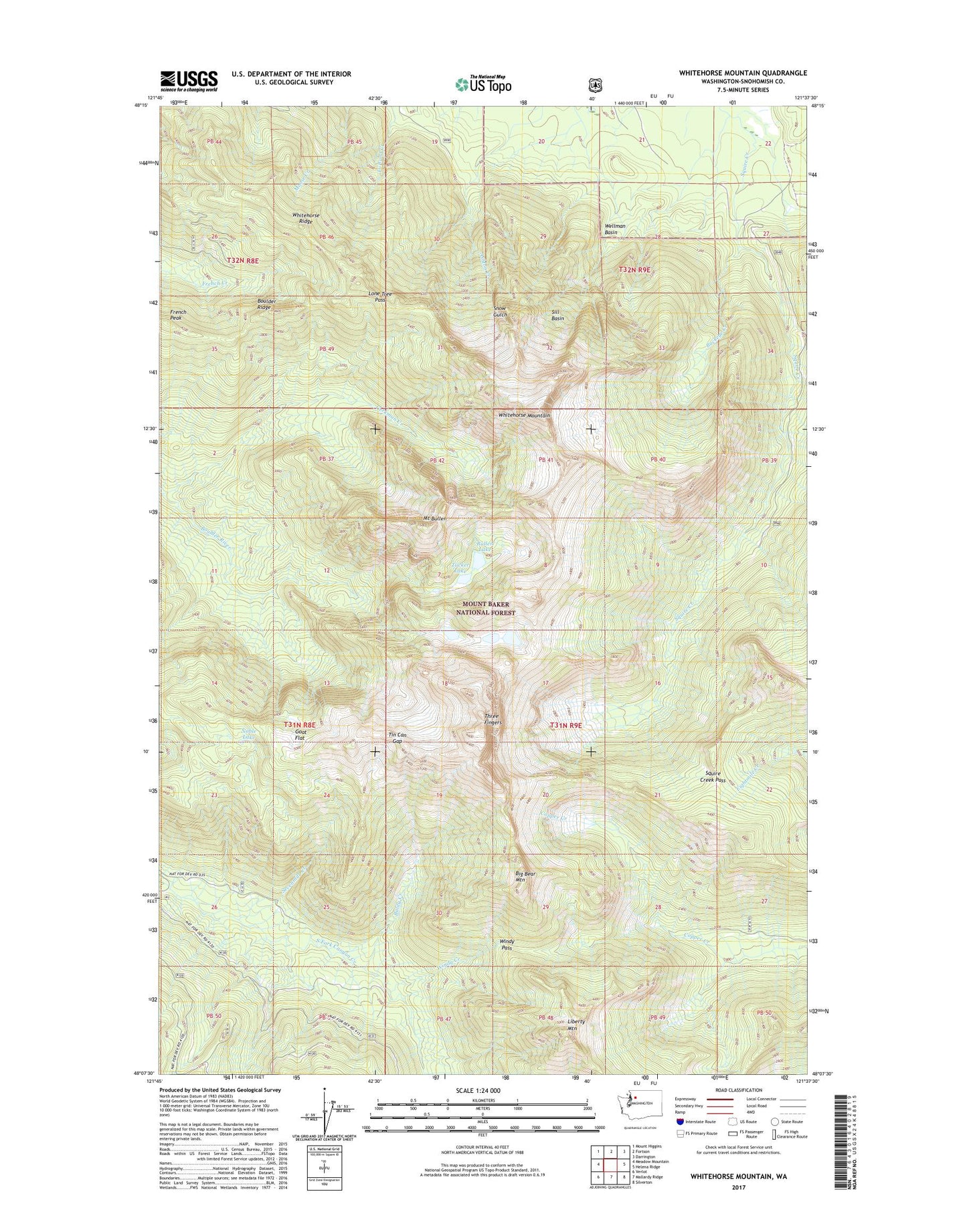
Whitehorse Mountain Washington US Topo Map
Couldn't load pickup availability
Also explore the Whitehorse Mountain Forest Service Topo of this same quad for updated USFS data
2023 topographic map quadrangle Whitehorse Mountain in the state of Washington. Scale: 1:24000. Based on the newly updated USGS 7.5' US Topo map series, this map is in the following counties: Snohomish. The map contains contour data, water features, and other items you are used to seeing on USGS maps, but also has updated roads and other features. This is the next generation of topographic maps. Printed on high-quality waterproof paper with UV fade-resistant inks.
Quads adjacent to this one:
West: Meadow Mountain
Northwest: Mount Higgins
North: Fortson
Northeast: Darrington
East: Helena Ridge
Southeast: Silverton
South: Mallardy Ridge
Southwest: Verlot
This map covers the same area as the classic USGS quad with code o48121b6.
Contains the following named places: Baldy Creek, Big Bear Mountain, Boulder Ridge, Boulder River Wilderness, Buckeye Creek, Bullen Lake, French Peak, Gerkman Creek, Goat Flat, Liberty Mountain, Lone Tree Pass, Mount Bullen, Mount Bullen Lakes, Noble Lake, Queest-alb Glacier, Sevenmile Creek, Sill Basin, So-Bahli-Alhi Glacier, Squire Creek Pass, Three Fingers, Tin Can Gap, Tucker Lake, Wellman Basin, Whitehorse Mountain, Whitehorse Ridge, Windy Creek, Windy Pass