MyTopo
Ginkgo Washington US Topo Map
Couldn't load pickup availability
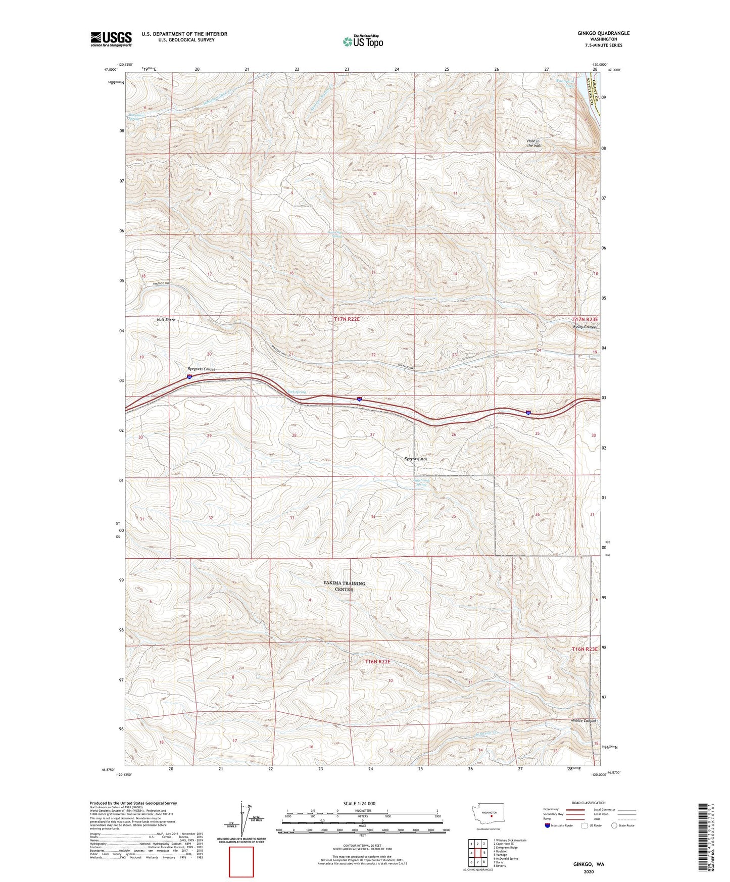
2023 topographic map quadrangle Ginkgo in the state of Washington. Scale: 1:24000. Based on the newly updated USGS 7.5' US Topo map series, this map is in the following counties: Kittitas, Grant. The map contains contour data, water features, and other items you are used to seeing on USGS maps, but also has updated roads and other features. This is the next generation of topographic maps. Printed on high-quality waterproof paper with UV fade-resistant inks.
Quads adjacent to this one:
West: Boylston
Northwest: Whiskey Dick Mountain
North: Cape Horn SE
Northeast: Evergreen Ridge
East: Vantage
Southeast: Beverly
South: Doris
Southwest: McDonald Spring
This map covers the same area as the classic USGS quad with code o46120h1.
Contains the following named places: Ginkgo Petrified Forest State Park, Hells Kitchen, Hult Butte, Lone Star Spring, Rock Spring, Ryegrass Mountain, Sagebrush Spring