MyTopo
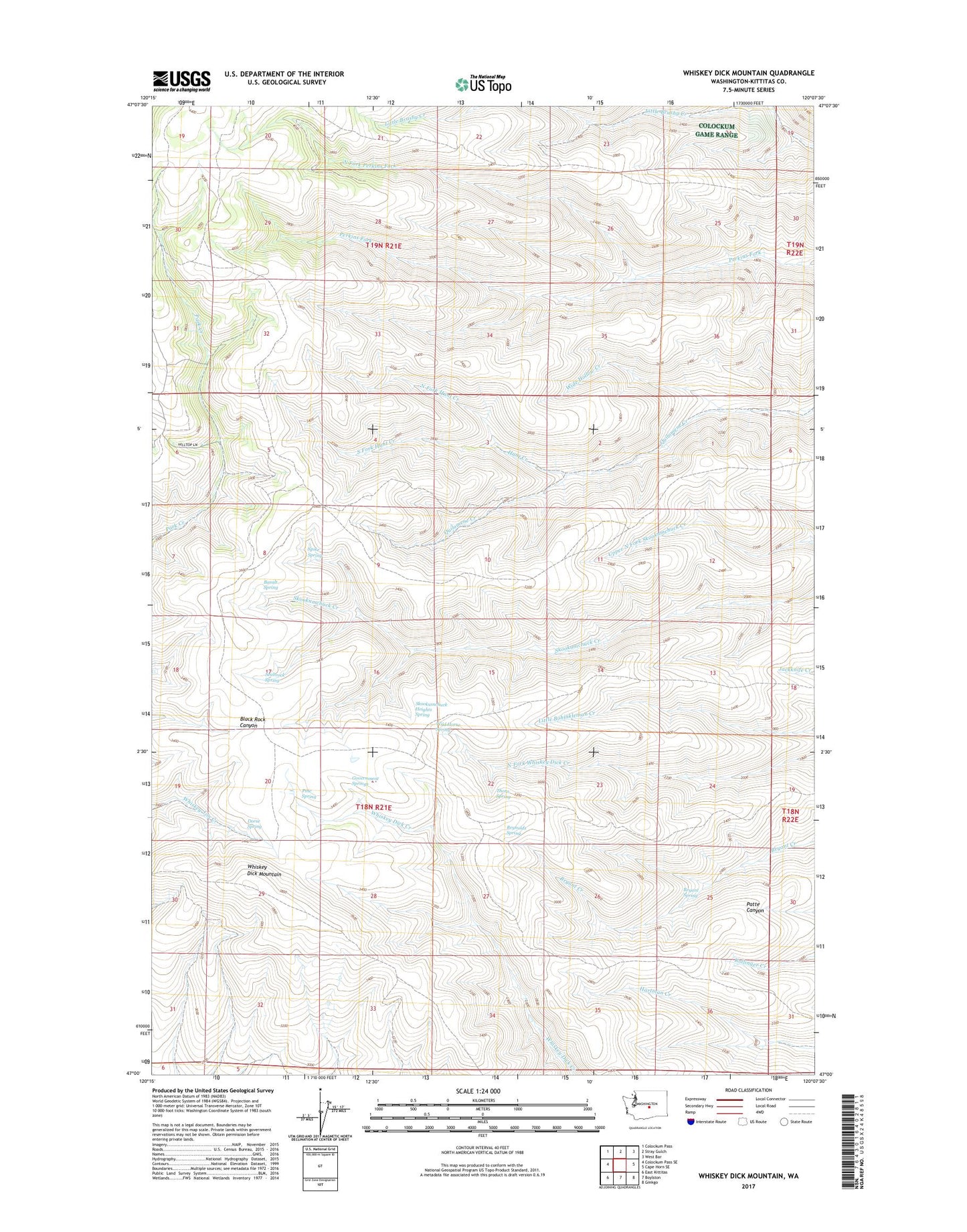
Whiskey Dick Mountain Washington US Topo Map
Couldn't load pickup availability
2023 topographic map quadrangle Whiskey Dick Mountain in the state of Washington. Scale: 1:24000. Based on the newly updated USGS 7.5' US Topo map series, this map is in the following counties: Kittitas. The map contains contour data, water features, and other items you are used to seeing on USGS maps, but also has updated roads and other features. This is the next generation of topographic maps. Printed on high-quality waterproof paper with UV fade-resistant inks.
Quads adjacent to this one:
West: Colockum Pass SE
Northwest: Colockum Pass
North: Stray Gulch
Northeast: West Bar
East: Cape Horn SE
Southeast: Ginkgo
South: Boylston
Southwest: East Kittitas
This map covers the same area as the classic USGS quad with code o47120a2.
Contains the following named places: Basalt Spring, Bryant Spring, Dorse Spring, Government Springs, Hunt Creek, North Fork Hunt Creek, North Fork Perkins Fork, Pine Spring, Quilomene Wildlife Recreation Area, Reynolds Spring, Seabrock Spring, Skookumchuck Heights Spring, South Fork Hunt Creek, Spike Spring, The Pines, Thorn Spring, Whiskey Dick Mountain, Wide Hollow Creek, Wild Horse Spring